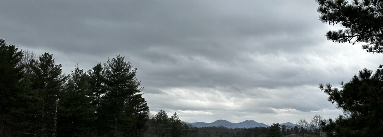
Fall-like temperatures carried over into December, but our fall drought faded as wetter weather emerged last month. A few areas also picked up snow, but most of the state finished 2023 with no accumulations.
Warm Throughout December
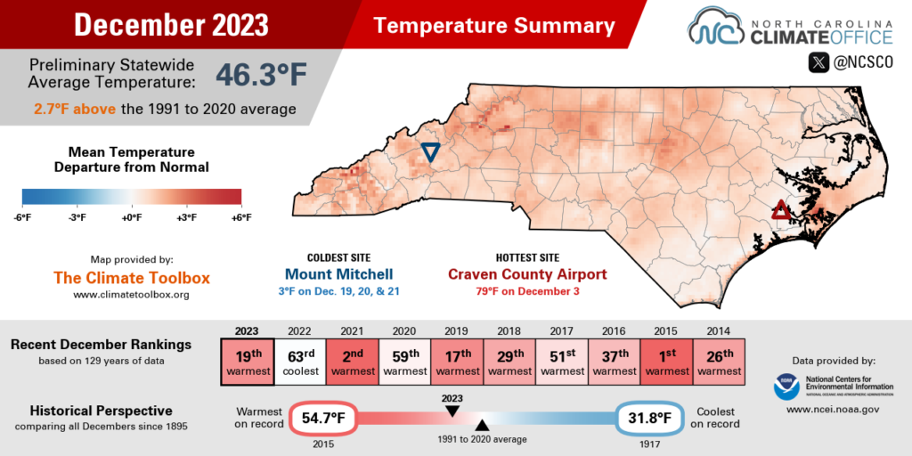
The calendar said it was December, but it rarely felt like winter thanks to prevailing warmth last month. The National Centers for Environmental Information (NCEI) reports a preliminary statewide average temperature of 46.3°F and our 19th-warmest December since 1895.
That puts this month in the company of other recent warm Decembers, including our 2nd-warmest December in 2021 that saw temperatures in the 70s on Christmas Day and New Year’s Eve, our 17th-warmest December from 2019, and our El Niño-fueled record warm (and wet) December in 2015.
Locally, it was tied for the 15th-warmest December in Greensboro, the 10th-warmest in Raleigh, and the 6th-warmest in Wilson dating back to 1937. In the northern Mountains, Transou had its 8th-warmest December in the past 74 years, and Boone had its 13th-warmest since 1980.
Indeed, this December was a warm one from the drop of the hat, with high temperatures hitting the low 70s on December 3 and 9 thanks to high pressure parked off our coast and a mild southerly wind flow.
The coolest stretch of the month was on December 19 and 20, when a chillier high pressure system passed to our north. That kept our high temperatures mostly confined to the 40s, with nighttime lows dipping into the teens across the western half of the state.
But that cooldown didn’t last long, as we were back into the 60s for the first day of astronomical winter. And in a far cry from the cold snap one year prior, when temperatures on the morning of December 24, 2022, plummeted into the single digits, we had short-sleeve weather on Christmas Eve last month, with highs in the mid to upper 60s in many areas.
That December warmth also solidified one of the top five warmest years on record for much of the state, with Raleigh and Salisbury wrapping up their warmest years and Charlotte tying for its 2nd-warmest year on record.
We’ll have a full breakdown of the final numbers for 2023, including the statewide and local rankings for the past year, during our annual North Carolina Climate and Weather Year-in-Review Webinar on Tuesday, January 16 at 11 am. Registration is required but free via this link, and a recording will be made available afterwards.
Soaking Rains Bring Drought Retreat
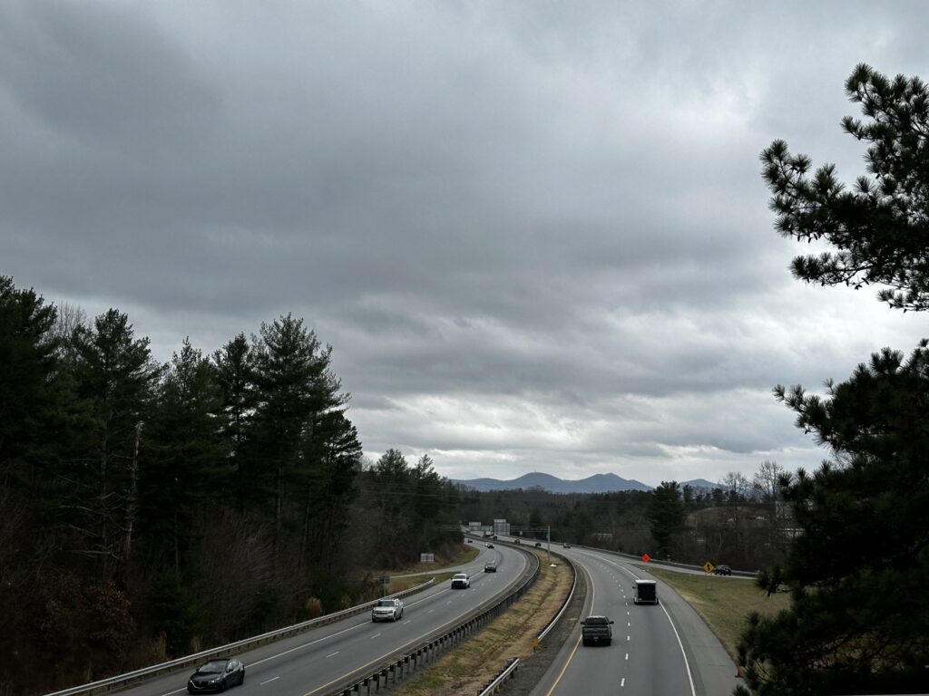
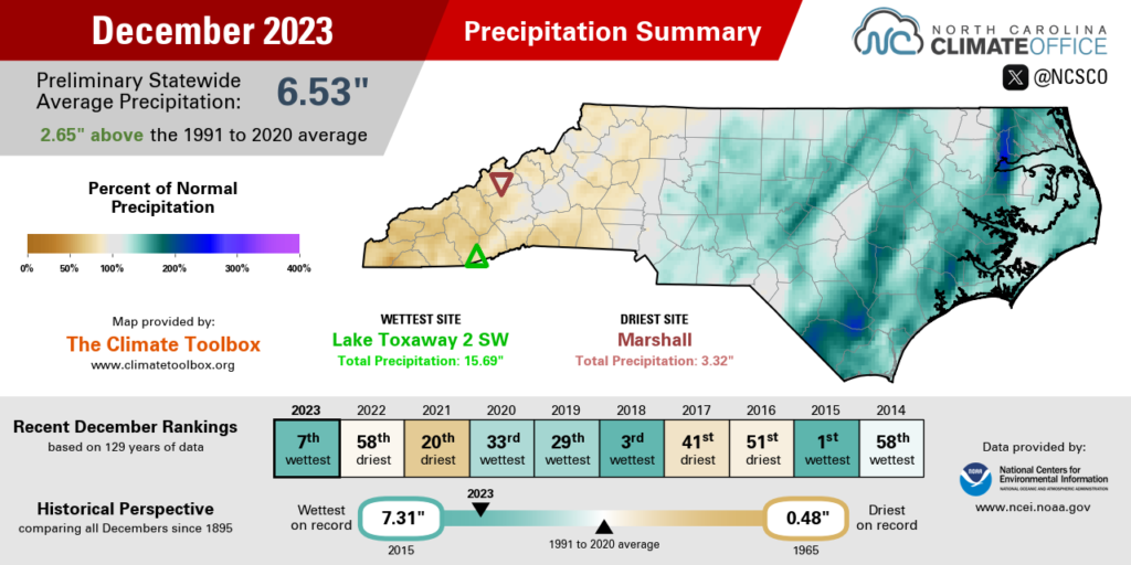
December may have felt like the fall, but our precipitation pattern was dramatically different, as regular – and often heavy – rains returned to North Carolina. NCEI notes a preliminary statewide average precipitation of 6.53 inches, which ranks as the 7th-wettest December out of the past 129 years.
It was the 2nd-wettest December on record for Greensboro, Raleigh, and Wilmington, and the wettest dating back almost 50 years for the coastal sites in Bayboro and Longwood, with more than 8 inches at both sites.
Even many western areas, which were hit hardest by the fall drought, got in on the moisture last month. With 11.26 inches in total, it was the 4th-wettest December on record in Marion, and it was the 9th-wettest December for Asheville. The 6.46 inches of precipitation there last month was almost double its 3.29-inch total from the entire fall season.
That rain came mainly from three events that each soaked much of the state:
- On December 10 and 11, moisture from the Gulf of Mexico poured in ahead of a cold front, yielding rainfall totals of up to 3 inches across parts of the Piedmont. The 2.30 inches in New Bern was its most in a single event since Tropical Storm Ophelia in late September. That system also spawned a rare December tornado in Garner.
- From December 16 to 18, a low pressure system moving up the coastline dropped more than 4 inches of rain in parts of the southern Coastal Plain, including 6.64 inches at our ECONet station in Whiteville.
- Between December 25 and 27, low pressure farther inland brought a widespread 2 or more inches of rain across the western half of the state. CoCoRaHS observers from Brevard to Boone reported totals of more than 6 inches.
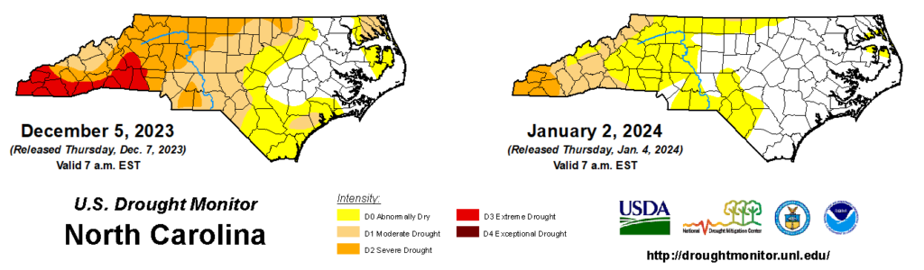
The net effect of that rainfall was a remarkable one-month turnaround, both on the US Drought Monitor and with our key indicators of drought across the state.
At the beginning of December, almost 58% of the state was classified in some level of drought, with 9% in Extreme Drought – the second-most intense category, which hadn’t been seen in North Carolina since the spring of 2017.
In the January 2 Drought Monitor assessment, that Extreme Drought is gone, and just 13% of the state is classified in Moderate (D1) or Severe (D2) Drought.
The December rain made a decisive dent in our precipitation deficits. Asheville finished the fall 8.07 inches below its normal precipitation, but by the end of December, the three-month deficit there was down to 3.18 inches. In Tryon, the three-month deficit shrunk from 11.93 inches to 2.89 inches during December. And Wilmington finished the fall 7.27 inches below normal, but it ended December 1.39 inches above normal over the previous three months.
Streamflows also reversed course due to the wet weather. On November 20, 91% of gauges across the state had below-normal 28-day average streamflows. By January 2, that was down to just 1%, with those few low flows in the far western corner of the state along the Oconaluftee, Tuckasegee, and Valley rivers, where Severe Drought remains.
Perhaps the biggest change among our indicators was the rapid recharge to reservoirs. In mid-November, Jordan Lake was more than 4 feet low, with broad expanses of exposed shoreline. At the end of the year, the lake was 3.5 feet above its target, and the heavy rain farther downstream prompted swift water rescue efforts for missing kayakers along the Cape Fear River.
Amid all of those impacts is a common denominator: El Niño, which is evident in the frequent moisture-laden storm systems that moved in from the south and east last month. While our winter outlook speculated that those impacts may not arrive until January, our December weather is a strong sign that this El Niño wasn’t wasting any time in kicking in.
A Snow Drought Continues
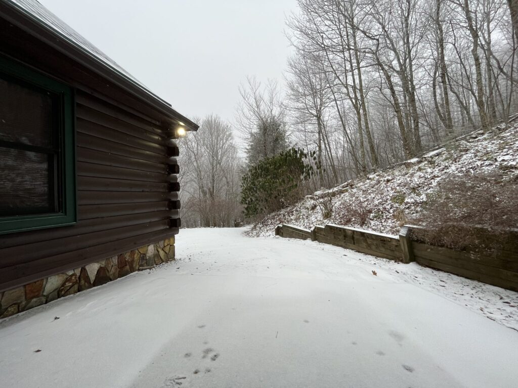
There was plenty of liquid precipitation to go around in December, but not much snowfall so far this season thanks to the warm weather in place last month.
A few higher-elevation sites did get cold enough for flakes to fall, though. On December 6, snow showers brought up to 2 inches of accumulation in the Waynesville area. On December 19, 1 to 2 inches fell across Ashe and Watauga counties, including 1 inch in Boone – its first measurable snow of the season, almost three weeks later than the December 1 average date.
There was no White Christmas in North Carolina this year, but the holiday week did see a light dusting on December 30, with as much as 1.5 inches on Beech Mountain.
Our highest-elevation location at Mount Mitchell had two measurable snow events last month, with 2.2 inches on December 19 and 0.8 inches on December 30. That 3-inch monthly total is a bit behind its normal December snowfall of 19.70 inches.
Of course, 3 inches is more than most of the state saw during the entirety of 2023, as it ended as a snowless calendar year for much of the Piedmont and Coastal Plain. In Greensboro and Raleigh, it was the first snowless year since 2019. For Charlotte, it was the first since 2012, although four of the past five years there have had less than half an inch of snow in total.
We’re also going on two years since the last measurable snow event, which in many areas was in January 2022. Coastal sites including Wilmington and Hatteras haven’t seen an inch or more in a single event since January 2018.
Even Asheville had no measurable snow in 2023, which was only its fifth snowless year in the past six decades, along with 1964, 1990, 2012, and 2019. And it’s now in the midst of its second-longest gap on record between snow events, at 661 days and counting since the last measurable snowfall on March 13, 2022.
But with our climatologically coldest and most favorable months for wintry weather still ahead of us, we can’t count out snow in 2024 just yet, even after such a warm December.
Just as the hydrological drought ended or abated in many areas last month, the ongoing El Niño plus a timely dash of cold air could spell the end of the snow drought at some point this winter.