Recent Posts

A photo of snow on the ground in Valle Crucis, NC, on December 26.

A Christmas Chill Decked December’s Halls

December’s temperatures were marked by a big cooldown just in time for Christmas. Rain throughout the month lifted the Mountains out of drought. And a...
A screenshot of the AIR tool showing hourly PM2.5 concentrations, winds, and a satellite-derived smoke analysis at 3 pm on July 21, 2021

AIR Tool Offers Air Quality and Weather Data, in Detail

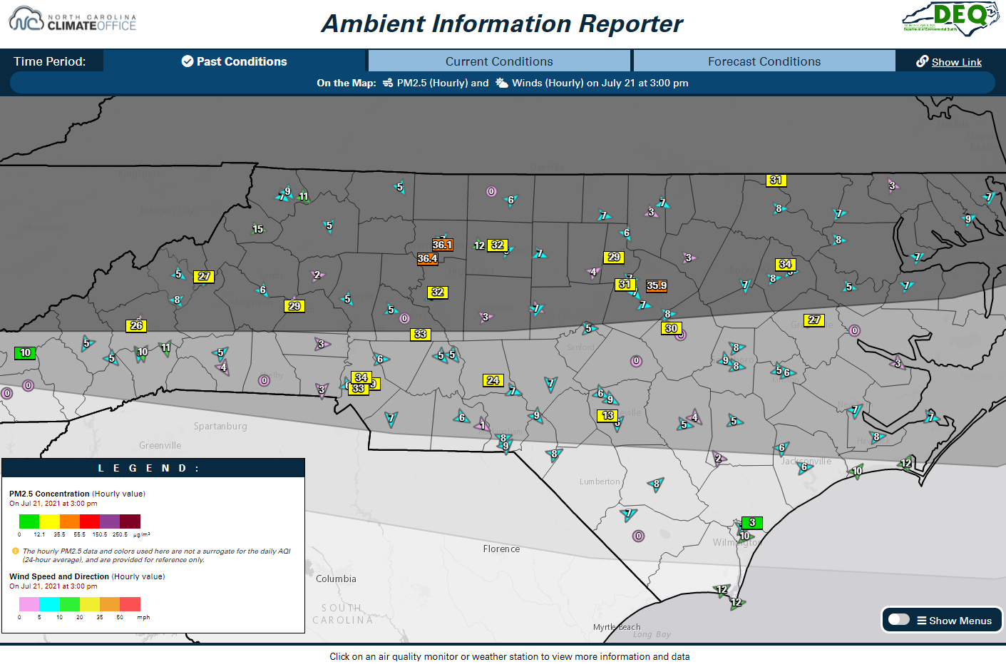
The State Climate Office and the North Carolina Division of Air Quality (NCDAQ) have partnered to build a new monitoring tool for those times when...
Hourly temperature and precipitation data from the Castle Hayne ECONet station, plotted on an interactive and exportable graph in Station Scout.

Our New Website Offers Data on Demand, ECONet Insights

We’re proud to officially launch our new-look website today, and our current design is more than just a fresh coat of paint. Here’s an overview...
March 2021 Precipitation Map

Spring Blooms in March, But Winter Wetness Lingers

Our new website launches next week, and we’re using it to help illustrate a warm March that dried out in some areas but remains generally saturated after our wet winter....

High-Resolution Drought Monitoring

Earlier this week, we talked about how drought is monitored and why spring is a good time to take a step back and evaluate how...

An Introduction to our Severe Weather Tools

The World Meteorological Organization defines severe weather as dangerous meteorological phenomenon, of varying duration, with risk of causing major damage, serious social disruption and loss...

First Freeze for Autumn 2013: How Does it Compare?

Thursday, Friday, and Saturday will likely produce the first freeze events of the season across most of the lower elevations of North Carolina. Higher elevations...