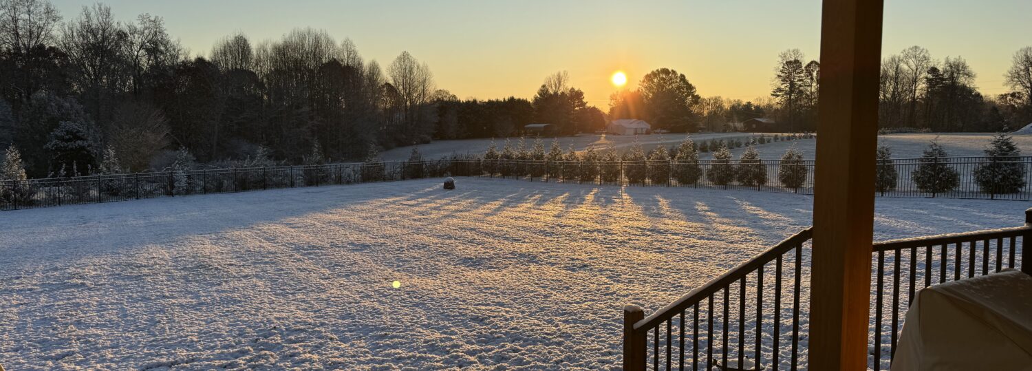
December started with snow and finished with heavy rain in the Mountains, sandwiching unseasonably warm spells that added to a near-record warm year. We also check on recent and possible upcoming snow events.
Wet in the West, Including Snow
Wet conditions in the Mountains were offset by drier weather across the eastern two-thirds of the state, making December slightly drier than normal overall. According to the National Centers for Environmental Information (NCEI), last month’s preliminary statewide average precipitation was 3.08 inches, which ranks as the 51st-driest December since 1895.
After two dry months following Hurricane Helene, several rounds of significant precipitation affected western North Carolina in December, where it was a wetter-than-normal month in many areas. Marion was 2.83 inches above normal in its 12th-wettest December on record, Mount Airy was 3.09 inches above normal for its 5th-wettest December, and Highlands had its 14th-wettest December out of 119 years of observations with a 4.35-inch monthly surplus.
In some of those areas, the first precipitation of the month came in a frozen form. Light snow showers on the morning of December 3 totaled up to 4 inches in the Mountains and up to 2 inches in parts of the western Piedmont as measured by CoCoRaHS observers. (See the Seasonal Snow Update section of this post for more on that event and its effect on several long-running snow droughts.)
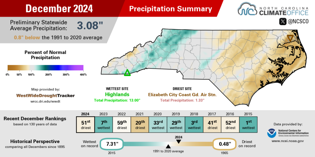
Later in the month, precipitation fell as mostly rain during frontal passages on December 10 and 29. During both events, the highest amounts again fell across western North Carolina, including more than 3 inches in the Foothills and southern Mountains on December 11 and local totals of 2 to 5 inches on December 29.
At the other end of the state, eastern North Carolina missed out on the heavier rains, and some areas had less than 2 inches in the entire month. The 1.51 inches in New Bern made for its 11th-driest December on record, and Elizabeth City had just 1.33 inches in tying its 12th-driest December since 1934.
While it was drier than normal at Piedmont sites including Charlotte (-0.60 inches), Greensboro (-0.42 inches), and Raleigh (-1.34 inches), the mid-month rains did lift that section of the state out of drought and back to the Abnormally Dry (D0) designation on the US Drought Monitor, reflecting seasonal rainfall deficits dating back to October.
Moderate Drought (D1) remains across most of the Coastal Plain, where streamflow levels have been on the decline amid an ongoing dry pattern since the fall. Meanwhile, much of the Mountains are no longer designated as Abnormally Dry following the heavy rain totaling more than 2 inches during the final week of the month.

A Warm End to a Warm Year
Those few cool and snowy days notwithstanding, there was plenty of warmth in December as well. NCEI’s preliminary data shows a statewide average temperature of 43.8°F and our 41st-warmest December out of the past 130 years.
After the first freeze was delayed to record levels in some areas in November, winter had undoubtedly arrived by early December. Widespread lows in the 20s during the first few mornings of the month finally ended the growing season for the handful of coastal sites that were still waiting for a freeze, including Cedar Island and Swanquarter.
But that initial chill quickly gave way to more warm weather, including highs in the 60s by December 8. The mercury hit the 70s across eastern North Carolina on December 10 and 11, with Wilmington recording a rare reading of 80°F – something that had only happened 22 times in 90 previous Decembers there.
One week later, the October-like temperatures returned across an even broader stretch of the state on December 18, with 70°F highs from Asheville to Asheboro to Ahoskie. And for good measure, some eastern sites added one more 70-degree day on December 29, including highs of 73°F in Bayboro, Snow Hill, and Lumberton.
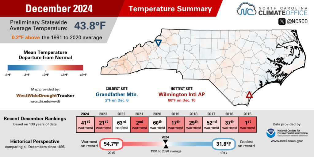
The seven 70-degree days in Elizabeth City last month was tied for the fourth-most in any December there, and Fayetteville tallied eight 70-degree days, which was the most in December since 2021.
That warm end to the year helped elevate 2024 among North Carolina’s warmest years on record. The preliminary data from NCEI shows it barely behind 2019, slotting in as our state’s 2nd-warmest year since 1895.
While we won’t definitively know the final ranking until the official data is released by NCEI on January 10, we can safely say that 2024 will land among our top five warmest years on record, putting five of our state’s six warmest years since 2016.
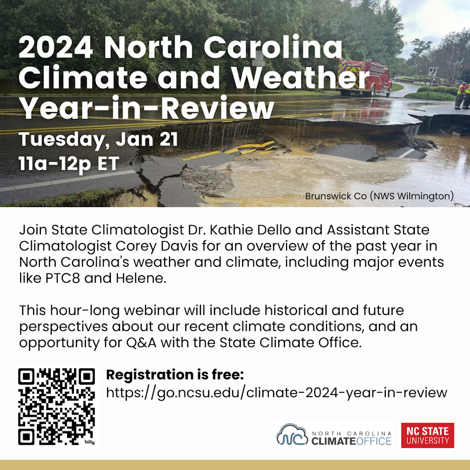
For more on the annual rankings, the major weather stories, and a climate perspective surrounding 2024, be sure to join us for our annual Year in Review webinar on Tuesday, January 21 at 11 am. Registration is required but free, and is now open via this link.
Seasonal Snow Update
Entering this winter, we weren’t optimistic about seeing much, if any, snow outside of the Mountains. That was a natural conclusion after nearly three years without snow, overwhelmingly warm recent winter temperatures, and a developing La Niña pattern that tends to produce fewer precipitation events locally.
But early December brought a surprise snow that finally ended some long-running snow droughts. In the western Piedmont, light snow fell along the I-77 and I-85 corridors, yielding accumulations of 2 inches in Statesville, 1.5 inches in Salisbury, and 0.4 inches in Greensboro. That broke a snow-free streak after 1,038 days, which was the 2nd-longest on record at each location.
Charlotte had a trace of snow that morning, so while it’s still waiting for its first measurable snow since January 29, 2022, it did see the first flakes since that event almost three years ago. Likewise for eastern areas such as Raleigh, the measurable snow drought now stands at 1,072 days as of January 5, which is just 92 days away from the record set between 1989 and 1993.
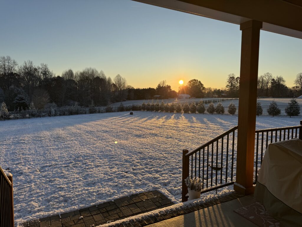
An early-season snow isn’t necessarily a sign of things to come in the rest of the winter. Most recently, up to a foot of snow fell across the northwest Piedmont in the second week of December in 2018, but that was the only snow of the season for most of those areas.
But as we head into the heart of winter – and our climatological coldest and most likely time for snow in January – there is some hope for snow based on the recent evolution of large-scale patterns and current forecasts.
For one, the borderline La Niña event remains exactly that. As NOAA’s latest ENSO Blog notes, the sea surface temperature anomalies in the equatorial Pacific Ocean have stalled out shy of the La Niña threshold. While some global atmospheric impacts have emerged, such as a strengthening of the tropical trade winds, the overall weaker ENSO pattern is having less of an impact on the jet streams in our part of the world.
Indeed, instead of ridging and warm air over the Southeast US like we’d expect from a La Niña, a jet stream trough set up over the eastern US last week, which allowed an Arctic air mass to surge southward across our region.
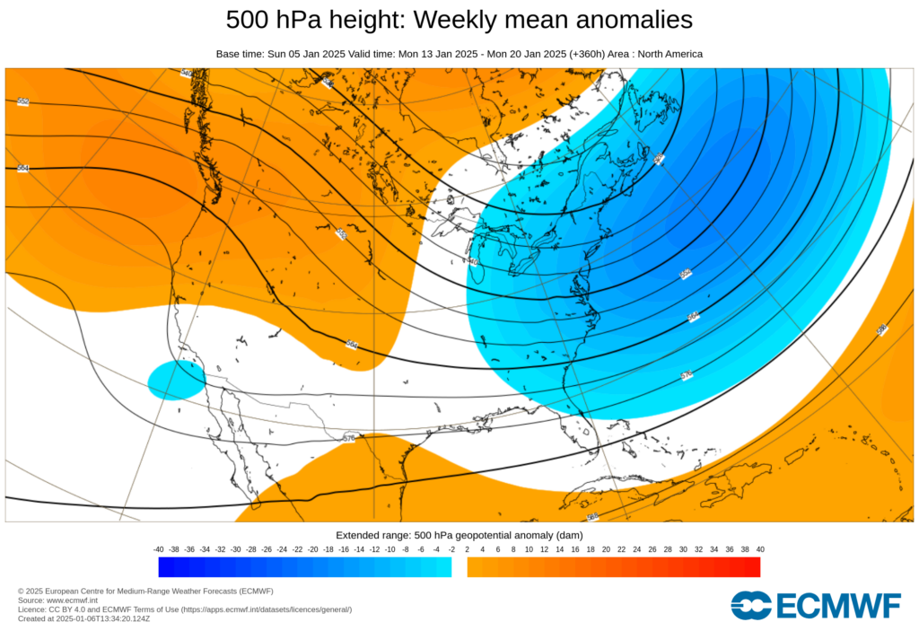
And it doesn’t appear that this will be a fleeting freeze. The Climate Prediction Center notes below-normal temperatures are likely through the middle of the month and possibly beyond.
Of course, just being cold is no guarantee of snow, as we also need moisture to fuel any frozen precipitation. We’ve seen one such system already this week, with light snow and freezing rain in the northern Piedmont on January 5 and 6. And if the cold holds, we could see more shots at wintry weather in the weeks ahead.
As a guide for what to watch for this month, we can look to January 2018, which was one of our last winter months with sustained cold weather. That month started in a similar chilly style, with an Arctic air mass building in and keeping our temperatures below freezing for more than a week.
During that cold spell, an offshore storm system on January 3 and 4 dropped up to 7 inches of snow in eastern North Carolina. After several cold frontal passages delivered reinforcing shots of cooler air, one of those fronts – with atmospheric support from an upper-level low – brought heavy snow to parts of the Piedmont and the coastline on January 17 and 18. It was the grand finale to an active winter month in North Carolina.
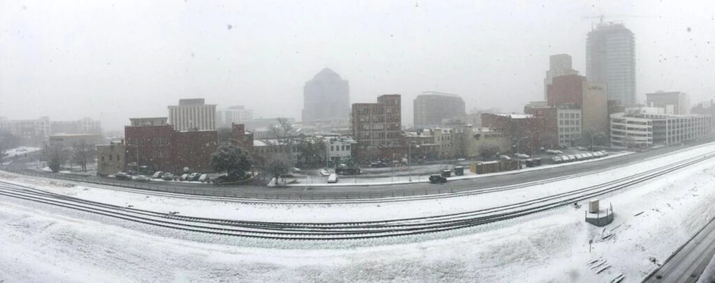
This month, we’ll also look to see how long the wintry chill will last, as that will keep the lower atmosphere cold enough for snow and the ground cold enough for any snow to stick more quickly. And we’ll watch for storm systems approaching in all directions: arriving from the west, developing to the south, or tracking up the coast.
For more on the patterns to watch for as we await potential wintry weather, check out our recently renovated Winter Storms portal, including new pages about large-scale patterns, precipitation types, and historical snow and ice storms.
While there’s no guarantee that those patterns will come together at just the right times for wintry weather, it’s certainly shaping up to be the most favorable month for snow across North Carolina in several years.
