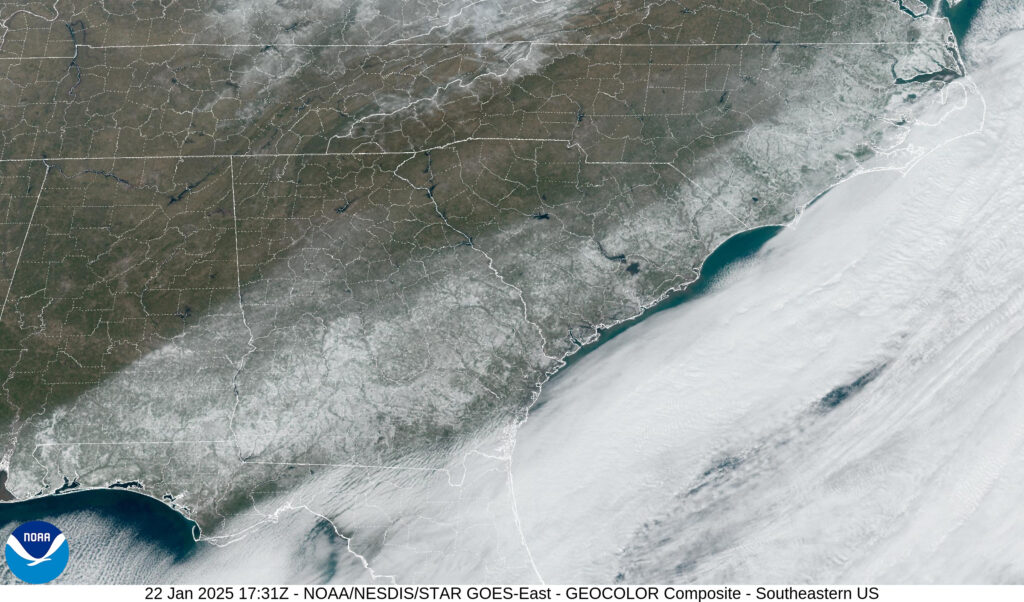
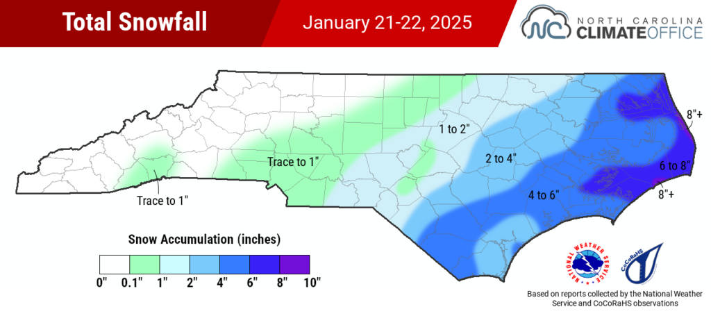
The second winter storm in a week and a half affected North Carolina on Tuesday night, and this time, it was eastern areas seeing the greatest accumulations and ending multi-year snow droughts.
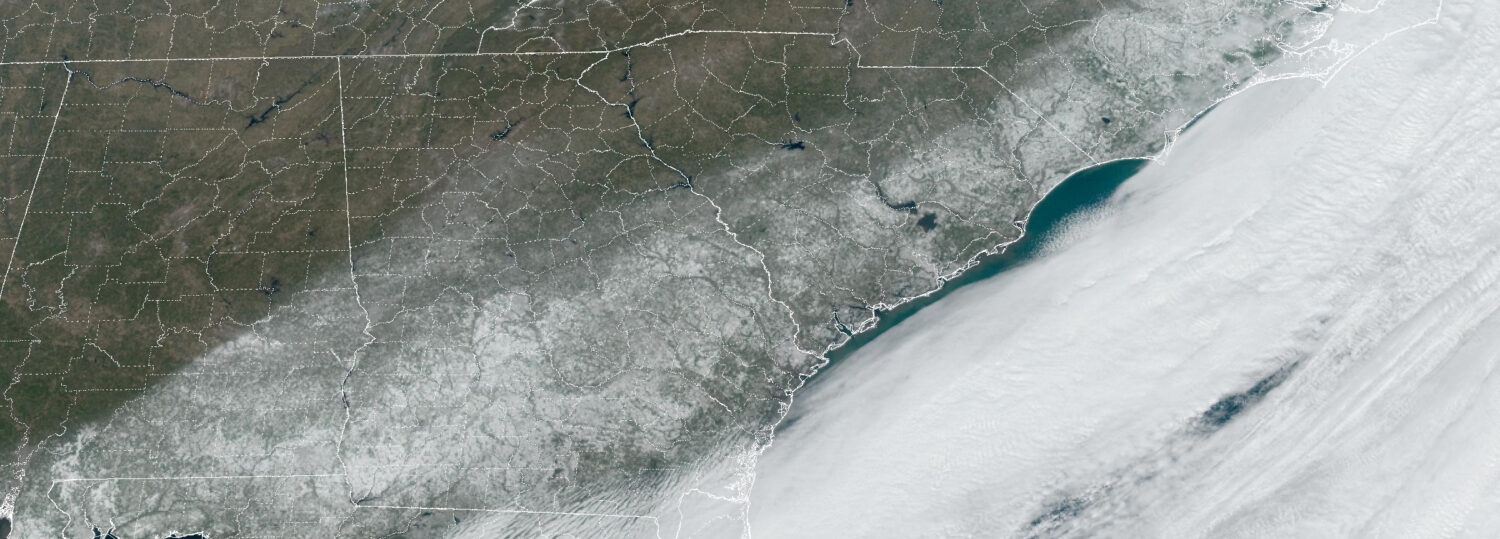
This event was part of a region-wide cold air outbreak courtesy of a deep trough in the jet stream that allowed an Arctic high-pressure system to dive unusually far south. Sub-freezing temperatures were recorded in Jacksonville, FL, with lows in the teens along the Gulf coast.
In eastern North Carolina, Tuesday was the coldest day locally since Christmas Eve in 2022, with afternoon highs of just 28°F in Goldsboro, Greenville, and Williamston.

Low pressure developing to the south of that cold air mass then supplied ample Gulf moisture that fueled rare and record-breaking snow in areas such as New Orleans and the state of Florida.
As that low tracked to our east, it was far enough offshore that little moisture reached western areas that picked up the highest snow totals earlier this month, but in a perfect position to bring frozen precipitation across eastern North Carolina.
Fluffy Snow and Lofty Totals
Unlike most of our winter storms that see a precipitation type tug-of-war as warm air moves in aloft, there was little drama this time. Aside from occasionally mixing with sleet right along the coastline, it was cold enough to fall as all snow on Tuesday night and Wednesday morning.
Since air temperatures were well below freezing, the snow fell as dry, powdery flakes with snow-to-liquid ratios of about 20 to 1. That boosted the totals compared to the 8-to-1 or 10-to-1 ratios we’re accustomed to from big, wet snowflakes that are constantly on the verge of melting in their trip through the lower atmosphere.
In the western Piedmont, which had just two or three hours with snow reaching the ground, accumulations were limited to 0.3 inches in Charlotte and a trace in Greensboro. Totals increased east of there, with 1.5 inches in Raleigh and 2 inches in Goldsboro. At both sites, it was the most snow in exactly three years, since January 21, 2022.
Most of the Coastal Plain had at least two inches, including 3.5 inches in Tarboro and 4.5 inches in Edenton. CoCoRaHS observations show around three inches in the Rocky Mount area, 4 inches in Kinston, and up to 5 inches around Jacksonville in Onslow County.

In southern Duplin County, Wallace had 4 inches for the first time since February 12, 2014. With a blanket of snow on the ground there, the temperature at our Wallace ECONet station dropped to 6°F early Thursday morning: its coldest reading in more than seven years.
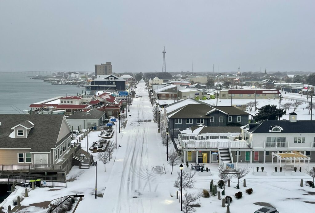
The highest snow totals came in from the coastline, including the Inner Banks and the Outer Banks. In Pamlico County, both Bayboro and Reelsboro reported 7 inches, and the National Weather Service relayed an 8-inch report from Okisko in Pasquotank County.
Along the Outer Banks, a CoCoRaHS observer in Rodanthe measured 8 inches and the National Weather Service received reports of 8.3 inches in Ocracoke and 9 inches in Kill Devil Hills. In those areas, it was the first six-inch snow event since January 17-18, 2018.
Snow Finally Returns
For parts of the Southeast US, this was a downright historic event, with more snow falling farther south than we’d ever seen before. That’s a testament to the right set of ingredients coming together, including an extensive cold air mass with a moisture-rich surface low tracking along its fringes.
In eastern North Carolina, it wasn’t a record-setter but it was a snow drought buster. Elizabeth City recently set its record long snow drought of 1,087 days dating back to late January 2022. That number will now reset after local totals of 4 to 8 inches.
With 1.5 inches recorded at the airport on January 21, Wilmington likewise ended a 1,087-day snow drought, which had been its ninth-longest on record. And Washington snapped its fifth-longest snow drought on record, which lasted almost exactly three years at 1,094 days.

Elsewhere in southeastern North Carolina, this event ended an even longer wait for a solid snow event. Parts of Brunswick and Columbus counties last had an inch or more of snow on January 11, 2011 – more than 14 years ago.
With local totals of 3 inches at the NWS Cooperative Observer site in Shallotte and 4 to 5 inches on Holden Beach and Ocean Isle Beach, this was the biggest snow for some parts of that southern coastal region since the Christmas blizzard in 1989.
In a winter that initially seemed unfavorable for snow, the entire state has now seen accumulations to end long snow droughts. And this event – plus the cold air surrounding it – has solidified this January as one for snow lovers to remember amid our sea of recent warm winter disappointments.
