Spring Begins With a Warm, Dry March

From the Mountains to the coast, North Carolina had warm weather and little rainfall during the past month.

Widespread Warmth Includes Few Chilly Nights
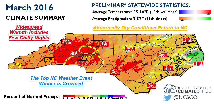
Continuing the spring-like pattern from the second half of February, March was quite warm across North Carolina. This March ranks as the 10th-warmest in the past 122 years with a statewide average temperature of 55.10°F — more than 5 degrees above the recent 30-year average.
Our normal high temperatures this time of the year are in the 60s, but highs regularly topped 70°F last month. Raleigh and Greensboro each had 17 days at or above 70°F, while Charlotte and Wilmington each had 19 days that warm, all of which rank among the top five most 70°+ days in March.
While we had plenty of warm days, we had few cold nights last month. Outside of the Mountains, most sites had less than five days with low temperatures at or below freezing. Raleigh had just 2 such days — the fewest since 1945 — and Charlotte had only 1 night that cold for only the third time in the past 75 years.
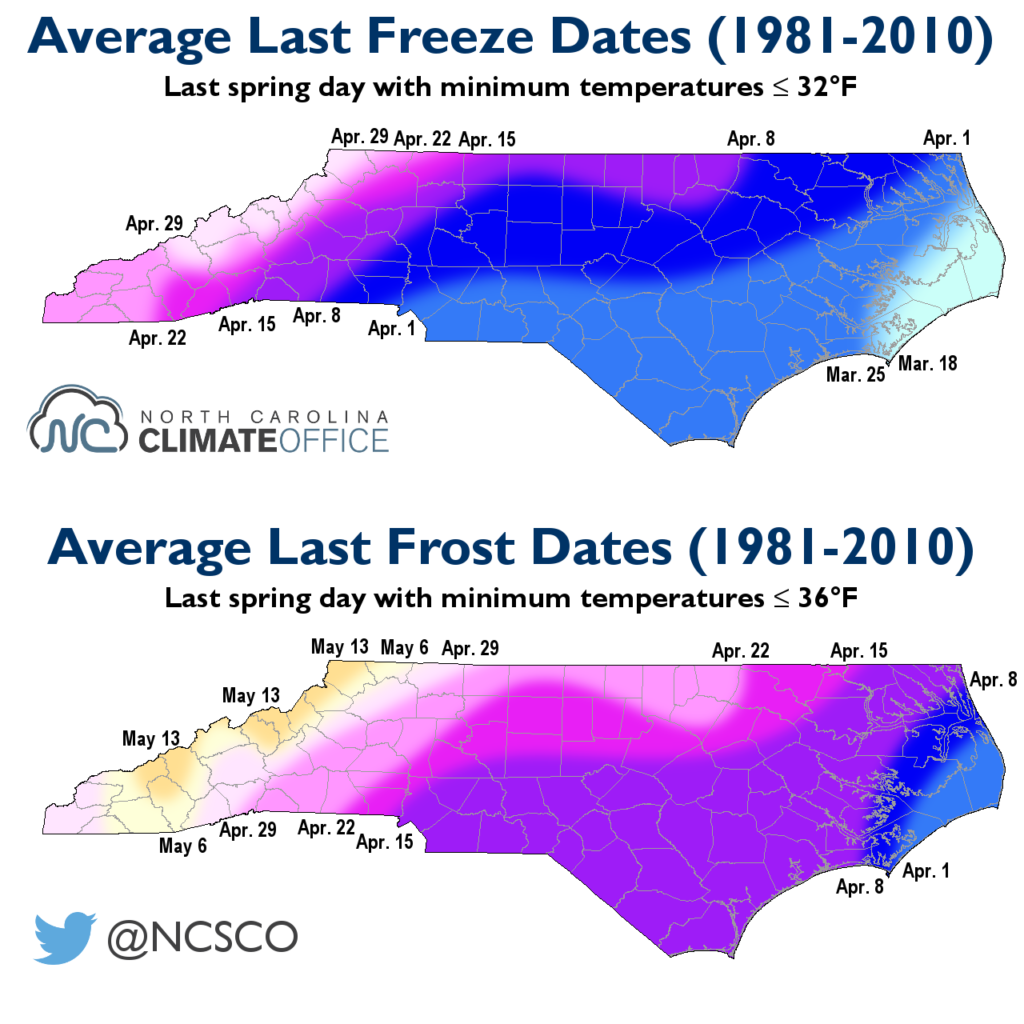
While the warm temperatures and lack of cool nights motivated some to plant early this year, we still can’t rule out any additional frost or freeze events. Historically, the last spring freeze occurs in the first two weeks of April across the Piedmont and Coastal Plain, while the average last spring frost usually happens by the end of April.

Abnormally Dry Conditions Return to NC
In a reversal of course from our wet winter, March was on the dry side across the state. The average statewide precipitation of 2.37 inches ranks as the 11th-driest March since 1895, with just half the precipitation of the 1981-2010 average. It was also our driest March since 2006, when the state averaged just 1.5 inches of precipitation.
Western North Carolina was particularly dry, with less than two inches of precipitation observed all month. Charlotte had just 0.85 inches — the 2nd-driest March there in the past 75 years. The warm temperatures and dry weather across the southwestern Piedmont led to declining streamflows in that region, and the US Drought Monitor re-introduced Abnormally Dry conditions in North Carolina for the first time since last October.
It’s not unusual for a dry month or two in the spring to precede an emerging drought by the summer. Last year’s drought emerged after a dry May, and the extreme 2007-08 drought came on the heels of a fading wintertime El Niño event and a warm, dry March.
Dry conditions now are also no guarantee that things will stay that way or get any worse, especially if we get some helpful April showers in the next month. However, it’s tough to say which way our weather will go as the current El Niño fades and we head into the warm season, since large-scale patterns like El Niño tend to have less of an effect on our weather during the late spring and summer.
The Top NC Weather Event Winner is Crowned
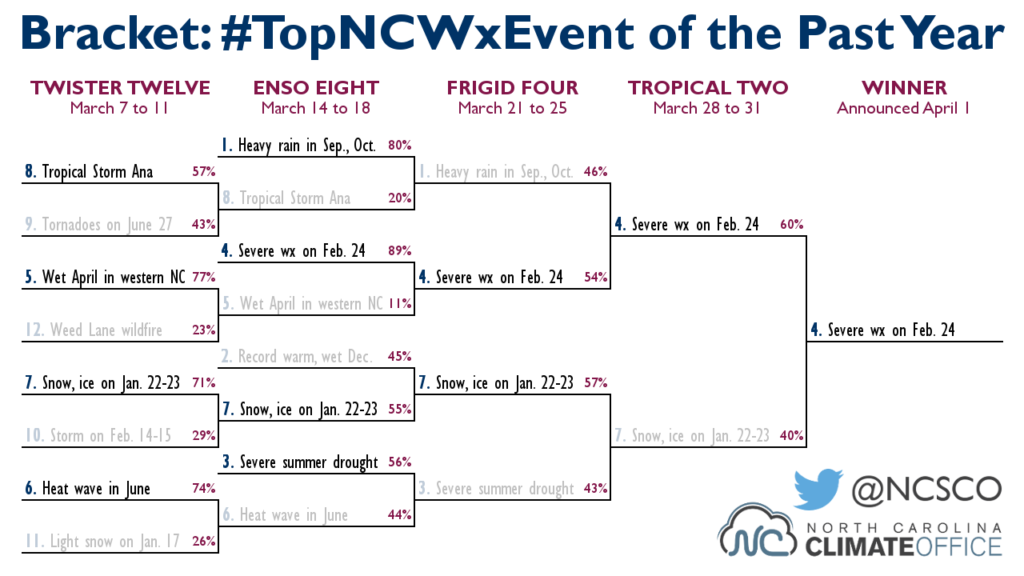
Last month, we held our own version of March Madness as our Twitter followers helped us choose North Carolina’s most memorable weather event from last March through this February.

While higher seeded events like last fall’s wet weather and last summer’s drought dominated the opening rounds, our Frigid Four featured a pair of upsets by lower-seeded but more recent events from the past winter.
With the final votes tallied, the severe weather event and tornado outbreak from February 24 just edged January’s snow and ice event to win the tournament and earn the title of the Top NC Weather Event from the past year.
While recency certainly helped both events in their tournament runs, the winning event was also likely aided by its rare early-season strength. With six confirmed tornadoes amid a pattern reminiscent of the April 2011 outbreak, the February 24 event is one of North Carolina’s most numerous February outbreaks.
That event also highlights one of El Niño’s many impacts on our winter. For more on the evolution of the El Niño event and how it affected our winter, be sure to check out our Winter Recap post here on the Climate Blog.
- Categories:


