What a wild weather weekend it was in North Carolina! After reaching highs near 60°F on Saturday, parts of the state woke up Sunday morning to light snow falling and the first flakes of the season in many areas.
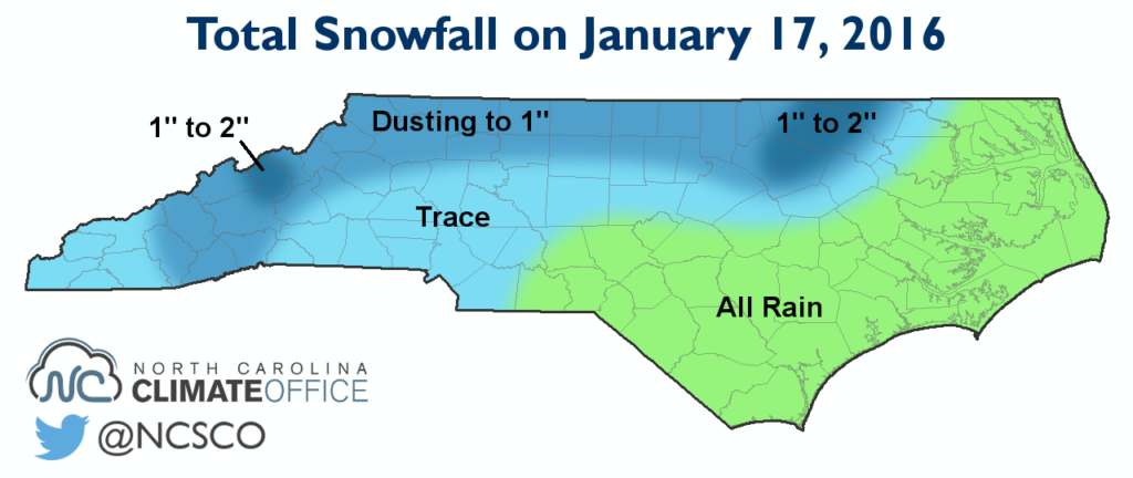
Across most of the Piedmont, accumulations were light and generally limited to a dusting on grassy surfaces. However, as a band of heavier snow moved across the northeastern part of the state, it brought totals of one to two inches in Franklin, Halifax, and Nash counties.
Overall, accumulations were limited by several factors. The surface low was fast-moving and the bulk of its precipitation was offshore, so precipitation totals were less than a tenth of an inch across the Mountains and western Piedmont. And in most areas, the precipitation began as rain before switching to wet snow.
In addition, the lack of a strong high pressure system directly to our north kept air temperatures above freezing, and the warm weather ahead of the system meant soil temperatures were in the 40s throughout the day. The warm ground temperatures also largely prevented impacts to roadways.
Although it wasn’t a major winter storm by any means, this event does highlight the winter pattern change we discussed earlier in the month. With the Arctic Oscillation bottoming out in a strongly negative phase, cold air and northerly jet stream energy dove southward from central Canada. To our south and east, the coastal low was the latest system on the conveyor belt of the El Niño-strengthened storm track.
If the southern branch of the jet stream remains strong and the northern branch remains weak and volatile, it may be just a matter of time before the cold air and moisture meet up at the right time to bring a winter storm to the Southeast US. As we near the climatological coldest and snowiest parts of winter, this event may be the appetizer for the main course to come.