Was June hot enough for you? Temperatures hit the 90s and 100s across the state last month, with dry conditions in the west and storms in the east.

Temps Top 100°F in a Summer Heat Wave
Oh, how quickly things can change! Just last month, we were talking about the return of 90s after a nearly eight month absence. But in June, 90s became the norm and parts of the state hit the 100° mark as the heat peaked mid-month. For many sites, it was the first occurrence of 100° temperatures since July 2012.
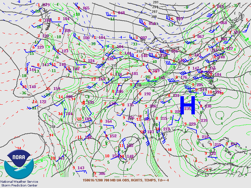
The statewide average temperature of 76.54°F made it our 10th-warmest June in the past 121 years. The culprit for our intense heat was a mid-level ridge (see the image below) that set up over the Southeast and brought in hot, dry air from the west and southwest.
The hottest temperatures came between the 13th and the 25th. Most of eastern North Carolina hit 100°F on the 16th, then continued on a prolonged period of hot weather. Raleigh hit 95°F on 12 consecutive days — from the 13th through the 24th — breaking the old streak of nine days from July 1977.
Charlotte was also hit hard by the heat. High temperatures hit 100°F at the Charlotte Airport five times. That’s the most ever at this point in the year, exceeding the three days at or above 100°F in the first half of 1952.
Most sites outside the mountains and immediate coast saw 15 or more days in the 90s last month. However, because we largely avoided such hot weather this spring, we’re not currently on pace to challenge our annual records for days exceeding 90°F. In Raleigh, we’ve hit 90°F or higher on 17 days so far this year. That’s 13 days behind the record-setting pace from 2011, when we had 30 days at or above 90°F by the end of June and we finished the year with 91 such days.
Drought Returns to Western NC
As we covered in a blog post last week, the combination of hot weather and an ongoing rainfall deficit has put parts of western North Carolina back into drought conditions for the first time since April 2013.
With that in mind, it may be surprising to see that the statewide average precipitation in June — 5.09 inches — was actually above normal: It was our 41st-wettest June on record. As is often the case, though, last month’s precipitation extremes became lost in the average.
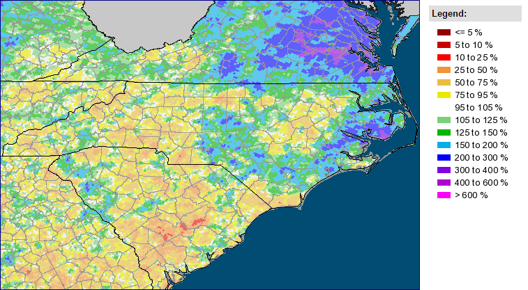
On the dry extreme, the western Piedmont including the Triad and Charlotte received less than three inches of rain all month, putting them an inch or more below their normal June precipitation. Greensboro had just 2.06 inches of rain, making it the 20th-driest June on record there.
On the wet extreme, the eastern Piedmont and much of the Coastal Plain benefitted from frequent shower and thunderstorm activity, especially in the last week of the month. New Bern had 7.77 inches of rain all month, making it the 9th-wettest June on record at that site. Wilmington (7.11 inches), Fayetteville (6.80 inches), and Raleigh (6.35 inches) all finished with above-normal rainfall and one of their top-20 wettest Junes.
Severe Storms Spawn Tornadoes in Eastern NC
Soaking rains weren’t the only effects of the storms. They also brought hail, damaging winds, and flooding, as the monthly roundup of Local Storm Reports below shows.
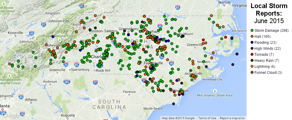
There were also six confirmed tornadoes across the state last month:
- On June 4th, an EF-0 briefly touched down near Columbia in Tyrrell County, damaging several homes.
- On June 13th, an EF-1 hit near Williamston in Martin County, causing snapped trees and damage to roofs.
- On June 27th, an EF-1 touched down near Cumnock in Lee County, also damaging trees and homes.
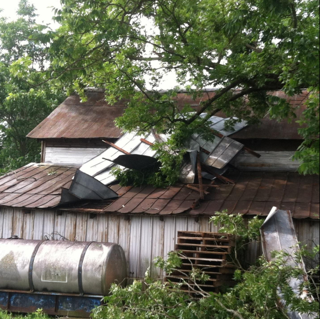
- Later on June 27th, three tornadoes struck southeastern North Carolina. First, an EF-0 was briefly on the ground in Sandy Creek just west of Wilmington. That night, an EF-1 hit near Raynham in Robeson County that night, snapping large trees and damaging some barns and farm equipment along its one-mile path. That tornado lifted but the same storm cell spawned another EF-1 tornado just southeast of Lumberton, again damaging trees and felling one that went through the roof of a home.
Fortunately, there were no injuries or deaths reported with any of these tornadoes. However, it was a particularly active month for severe weather after a relatively quiet year up to this point.