This post is part of a series highlighting the summer projects from our office’s undergraduate research assistants. This part of this series is by Melissa Mainhart, who is finishing her degree in Meteorology at NC State University.
When you think about summer, what comes to mind? Family vacations? Community swim team practices? For many people along the southern Atlantic coast, summer means tropical cyclones, hazards, and uncertainty.
While interning this summer at the National Weather Service (NWS) office in Charleston, SC, I had a chance to research the tropical cyclone impact climatology for their county warning area (CWA). This research opportunity was presented to me through the Ernest F. Hollings Scholarship, of which I am a recipient.
The Charleston CWA has eight coastal counties and covers portions of South Carolina and Georgia. It is located on an area of the Atlantic coast that has historically been impacted by significant number of tropical cyclones including major hurricanes like Hurricane Gracie (1959) and Hurricane Hugo (1989). The impacts of these storms on a specific area like the Charleston CWA has not previously been determined and are not well understood. This project was designed to better identify the impacts of tropical cyclones on the counties within the Charleston CWA so the Charleston NWS can educate their public more effectively about the specific impacts they can expect from tropical cyclones.
You may remember the State Climate Office’s recent research about the tracks of North Carolina’s landfalling hurricanes. Although my research did not focus solely on tropical cyclone track, it was one of the storm parameters I considered when looking at storm impacts.
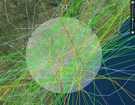
Building the impact climatology began with identifying tropical cyclones that passed within 175-mile radius of the center of the Charleston CWA between 1851 and 2013. Information about these storms was gathered from a variety of data sources including NWS Monthly Weather Reviews and the HURDAT Re-analysis Project database. These impact parameters include maximum recorded wind speed, minimum recorded pressure, number of spawned tornadoes, and maximum storm surge, which was calculated using the SLOSH model. It was these details about the tropical cyclones that I used to determine the impact that a particular cyclone may have had on the Charleston CWA.
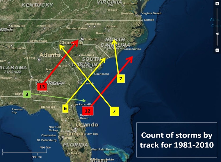
After determining as many impact parameters as possible for each tropical cyclone, I generated statistics, tables, and graphics that made the data easier to read and interpret. These products linked each of the individual tropical cyclones together and showed trends in how their impacts have changed over the years. The graphics can be used on the Charleston NWS office’s website and at outreach events to help make local communities more hurricane-ready.
The Hollings Scholarship requires that each recipient hold a nine week internship with a National Oceanic and Atmospheric Administration line office, such as the NWS, and then present our research at a week long symposium at the end of the summer. At this student symposium I had the pleasure of seeing all the current research that my peers are doing at different offices around the country and how this is impacting our collective understanding of our oceans and atmosphere.