
This post is part of a series highlighting the summer projects from our office’s undergraduate research assistants. This post is by Samuel Roback, who is currently a junior in the meteorology program at NC State University.
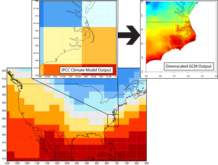
Global climate models produce projections of the climate which can be especially useful in helping to plan for the future. There are multiple climate models that cover the entire world and even more specific downscaled projections, derived from the global climate models, that cover numerous regions around the globe.
Downscaling refers to a process which translates the value of a variable (such as air temperature, or relative humidity) in a larger space to the value of a variable in a smaller space. Typically, coarser resolution data is taken from a global climate model and is run through a downscaling technique to produce higher resolution projections for a smaller region. Since there are many different techniques to do downscaling, there are many downscaled climate projections which have been created.
There are plenty of downscaled climate projections out there, all of which were created with different downscaling techniques that have differing intents. While they are publicly available, this does not mean that a given downscaled climate projection is appropriate for all user needs. However, many users don’t know how to tell which projections to use.
Projections are created with different downscaling techniques, and they may only cover a certain time period. These differences already make it difficult to determine the proper projection without guidance. On top of this, these differences can result in differences in accuracy for specific regions. Not knowing this metadata and accuracy information can often result in projections being used in ways they should not.
We wanted to take a step back, before the user even selects a projection. Currently there is no tool available that guides a user through this process of choosing an appropriate projection, only portals to directly obtain the projections with no guidance. These portals assume the user knows everything about the projections for which they are looking (accuracy, covered regions, etc), when in fact, they may not know any of this.
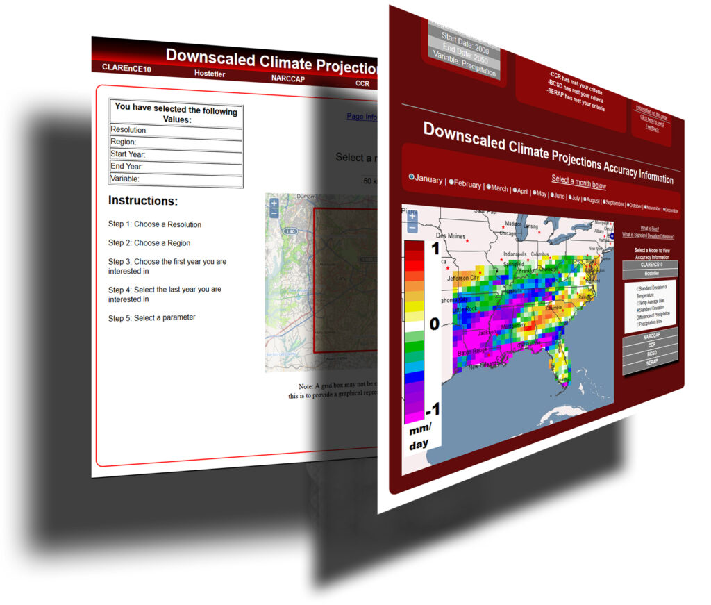
The Downscaled Climate Projection Search Tool, currently in development, does not assume that the users know about what the projections include. Instead, the tool asks users what parameters they require, such as resolution, region, start time and end time, and variables of interest (like precipitation or heating degree days). A results page provides a list of recommended projections and accuracy information for those projections. The accuracy information includes monthly data with different selection options for the current six projections, such as temperature or precipitation bias, as well as, temperature or precipitation standard deviation difference.
Recently, the alpha version of the Downscaled Climate Projection Search Tool was released to a small group of users who will be testing this tool as it progresses in development. Currently, there are only six downscaled climate projections available in the tool: however, this is expected to expand in the future. Improvements and changes to the tool will continue through the fall semester!