Aug 22, 2025
Rapid Reaction: Hurricane Erin a Close Call with Coastal Damage
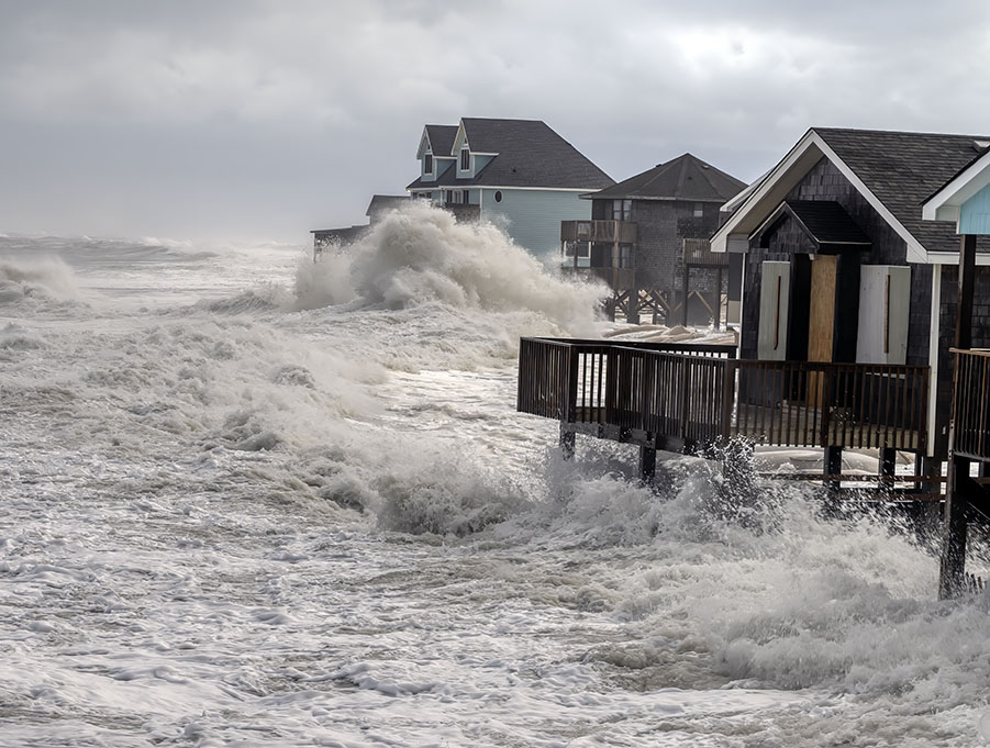
The first hurricane – and the first major hurricane – of the 2025 Atlantic hurricane season passed off our coastline this week, and despite not making a direct landfall, it still had big impacts in parts of eastern North Carolina. Over the warm water in the central Atlantic Ocean, Hurricane Erin became a formidable storm,…