The pattern change from our wet winter to a dry spring brought on one of North Carolina’s worst fire seasons in the last decade, with three large wildfires across the state last month.
That’s not to say we’re in an above-normal fire season, though. The past several years were particularly quiet, which makes this year stand out a bit more. In addition, our evolving weather from a wet, El Niño-dominated winter to the warm, dry conditions in March and April meant fire danger rapidly increased during the early spring, making the quick spate of fires seem all the more sudden.
Despite the lull in fire activity in recent years and the wet wintertime conditions, the NC Forest Service was prepared when the risk began rising this year according to Cabe Speary, Fire Environment Forester with the Forest Service.
“We knew that ENSO was moving to neutral, but we thought things would not pick up until late May at the earliest,” he said, adding that “when making pre-fire season predictions, we always tell our field personnel that it only takes a couple of weeks of drier-than-normal weather for fire occurrence to increase quickly, regardless of the long-term forecast.”
Fire Along the Coast
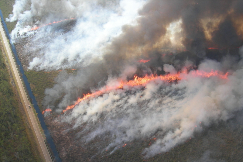
The first and largest of April’s three large wildfires started on April 18 near the Hyde/Dare County line in eastern North Carolina. The Whipping Creek fire was ignited by a spark from roadside machinery, and Speary said the lingering effects of the winter, especially cold morning temperatures on April 6 and 10, played a part in that.
“Some late frosts may have kept the grass on the road shoulder from greening up,” he said. “Dead grass on road shoulders during the late winter and early spring are where fires can start.”
In just one day, that fire grew to more than 4,000 acres in size and eventually consumed 15,453 acres before it was fully contained early this month.

While that fire occurred in the same region of the state as some of our largest wildfires on record — including the Evans Road fire in 2008 and the Pains Bay fire in 2011 — one key difference in environmental conditions helped keep this year’s blaze from persisting like its predecessors.
“Whipping Creek was different than Evans Road and Pains Bay in that there was not much fire burning into the soil,” said Speary. “The organic soil was wet from the past several months of higher-than-normal precipitation.”
As for those frost-killed grasses, Speary said that since vegetation has now greened up across the state, a similar fire starting in dead grass isn’t as likely this summer, even if conditions dry out again.
Planning an Attack
Lessons learned from those past fires did help the Forest Service respond to the Whipping Creek fire. Since land in that area is under the jurisdiction of multiple agencies, coordination between these groups let them better organize their attack to contain the fire once it started.
It’s all part of the multi-tiered approach that the Forest Service uses to manage fires across the state. Several levels of incident management teams, from Type 3 to Type 1, are available based on the complexity of an event and the amount of resources required.
Initially, local firefighting crews can be assisted by Type 3 teams, which consist of 8 to 12 people and can be on site within 24 hours. According to Speary, that frees up those local crews to focus on attacking new fires as they start.

Larger or more complex fires may require a Type 2 team; North Carolina has three of them, with more than 35 trained members in each. For the most complex events, including fires that cross jurisdictional lines, interagency Type 1 teams may be brought in.
That was the case with the Whipping Creek fire, and the additional support included federally contracted resources such as a Bombardier 415 Superscooper plane, brought in from Minnesota to spread large amounts of water over the fire-affected areas.
Crews from out of state often handle roles in planning, logistics, and finance, while personnel familiar with the local terrain and tactics typically handle the specific operations for each event.
Information at Your Fingertips
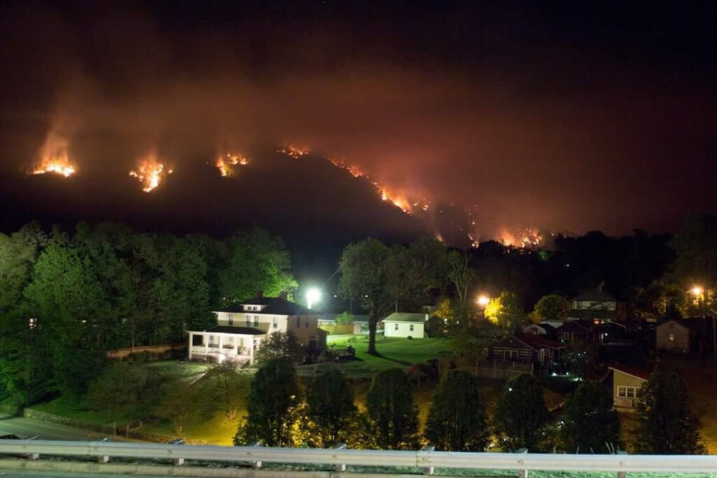
Along with the Whipping Creek fire, two other large wildfires burned last month. In the Mountains, the Silver Mine fire near Hot Springs burned 5,964 acres in the Pisgah National Forest before it was fully contained on May 4.
In Brunswick County, the Clemmons Road fire consumed 1,578 acres between April 19 and 27. That fire started when a debris burn got out of control and spread in the dry, windy weather. Speary said this is the most common cause of wildfires in North Carolina and encouraged anyone wanting to burn to be informed about the latest conditions.
“People planning to burn can either call their county ranger or go to the NCFS website to get tips about burning,” he said. “Of course, they need to pay attention to weather forecasts, watches and warnings. We discourage burning when there is a fire weather watch or red flag warning.”

When active fires are burning, the InciWeb website from the National Wildfire Coordinating Group gives updated information about the status and containment efforts of those events.
Our office also continues to work closely with the NC Forest Service to provide additional monitoring resources. The Fire Weather Intelligence Portal, which we previously covered on the blog, allows users to view past, current, and forecast conditions, including fire risk indicators that show when environmental conditions are primed for wildfires.
Additional improvements to the Portal are coming this summer such as a daily fire danger forecast map and a mobile-friendly site for easy use on the go. Stay tuned as we roll out these updates to help both the Forest Service and the public stay up-to-date about the latest conditions.