August is Cool for NC, Rainy in Spots
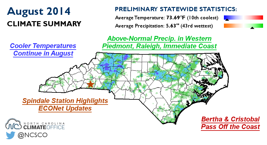
Following a cool July, August delivered more below-normal temperatures to North Carolina, as well as abundant rainfall in parts of the state.
Cooler Temperatures Continue in August
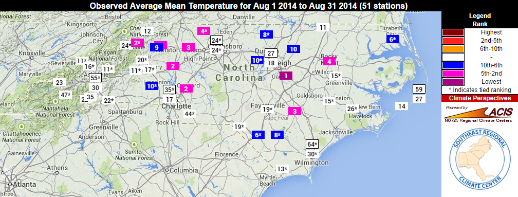
The statewide average temperature of 73.69°F makes it the 10th-coolest August on record for North Carolina. Several stations with at least 80 years of data, including Tarboro, Statesville, and Concord, had one of their top-five coolest Augusts on record based on the average mean temperatures.
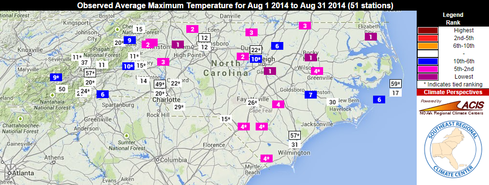
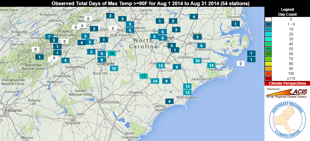
These cool rankings were largely due to our below-normal maximum temperatures. We spent much of the month with highs in the 70s and 80s. A late-month warmup saw temperatures return to the 90s, but outside the southern coast and Charlotte, most of the state saw six or fewer 90°+ days in the month.
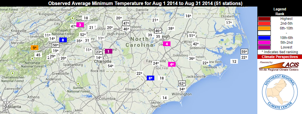
Minimum temperatures were closer to normal, but many sites in the southern Piedmont and central Mountains still had one of their top-ten coolest Augusts based on the low temperatures. During the final week of the month, lows regularly hit the 40s at the higher-elevation sites, and much of the state saw several fall-like nights with temperatures in the upper 50s.
Above-Normal Precip. in Western Piedmont, Raleigh, Immediate Coast
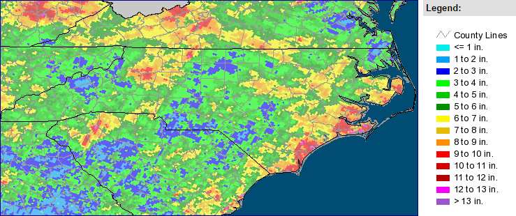
North Carolina was, on average, slightly wetter than normal last month, making it the 43rd-wettest August out of a 120-year record. There were several notable rain events during the month:
- On August 1st, storms along the coast brought the first soaking of the month to Atlantic Beach, which had a monthly total of 16.55 inches of rain. A waterspout was also reported just off the coast.
- On August 12th, heavy rain and storms over Wake County brought nearly 2.5 inches of precipitation to the RDU Airport. RDU received 6.87 inches of rain for the month, making it the eighth-wettest August on record for that station.
- Storms across the state between the 18th and 22nd brought hail and wind damage, along with 2 to 4 inches of rain in Wilmington, Kinston, New Bern, and Atlantic Beach. Flooding closed Highway 70 near Newport on the 21st.
- Storms moving through overnight on August 24th gave several inches to the western Piedmont. These showers and storms moved from north to south, which resulted in the distinct line between wet and dry spots across the western Piedmont in the monthly radar-based precipitation estimates.
In the western Piedmont, parts of Wilkes, Yadkin, and Alexander counties saw more than 7 inches of rain for the month, which put this among their top-ten wettest Augusts on record. Our ECONet station in Taylorsville reported 8.52 inches total.
There were also some impressive rainfall totals along the coast, including 10.05 inches at Cape Hatteras. That site had its 15th-wettest August out of the past 120 years, and it appears to be the third-wettest August (after 1992 and 1974) in which Hatteras received no rain from tropical systems.
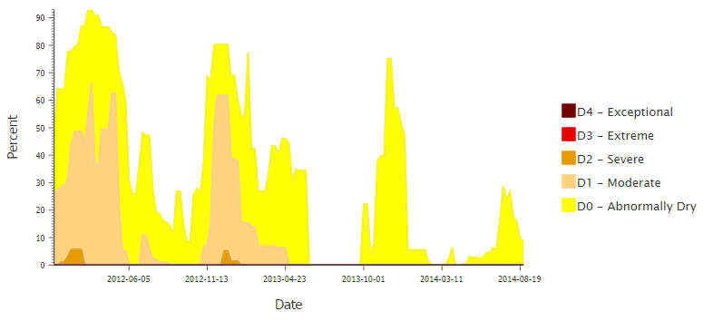
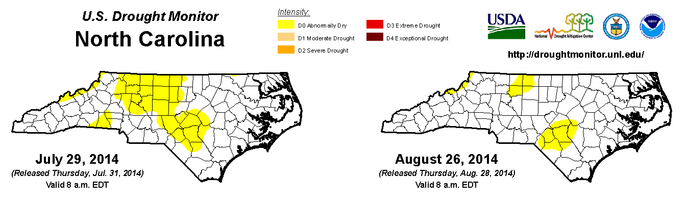
The rain in the northwest Piedmont helped alleviate some of the recent dryness in that area, although Abnormally Dry conditions remain in parts of the Triad, and in the eastern Sandhills including Fayetteville. Despite the lingering dryness this summer, it has been more than 16 months — since April 2013 — since any part of North Carolina has been classified in any drought category (D1 through D4) by the US Drought Monitor.
Bertha and Cristobal Pass Off the Coast
Following a direct hit from Hurricane Arthur in early July, North Carolina and the rest of the US largely avoided the effects from hurricanes Bertha and Cristobal. Both storms formed from tropical waves in the mid-Atlantic and grazed the Caribbean islands before curving back out to sea. The only notable impacts in North Carolina were high surf and rip currents along the coast.
The three named storms through the end of August are the fewest since 1994. When Cristobal reached tropical storm strength on August 24th, it was the eighth-latest naming of the season’s third storm since 1980, and the latest since 1992.
Spindale Station Highlights ECONet Updates
On August 14, we installed a new ECONet weather station in Spindale, on the campus of Isothermal Community College. We documented this installation in a blog post earlier this month, and an official ribbon-cutting ceremony is planned for September. You can always view the latest data from this station and all of our stations on our Weather Map tool.
Our instrumentation meteorologists were also busy in August doing routine maintenance across the eastern half of the state. At those stations, the radiation sensors, PTU modules (which measure barometric pressure, air temperature, and humidity), and anemometer bearings were replaced. Maintenance across western North Carolina is planned for this fall.
- Categories:


