Last week, we tweeted a graphic from the National Climatic Data Center (NCDC) showing when the warmest day of the year happens climatologically. According to this map, the warmest day of the year, climatologically speaking, occurs between July 11 and July 15 for the majority of North Carolina.
Two questions arose when this map was posted. First, why is the warmest day of the year not on June 21st, when we have the most daylight? And second, do our ECONet stations show similar results to the NCDC map from the previous ten years?
The answer to the first question is a phenomenon known as “seasonal temperature lag”. This occurs because, while the most incoming solar radiation does happen on the summer solstice, the earth does not re-radiate it back out immediately. Instead, the earth absorbs the radiation to warm up before re-radiating it back out to warm the air. This absorption process takes longer near large bodies of water since water has a higher heat capacity (meaning it can store more of this energy) and radiates it out back slowly.

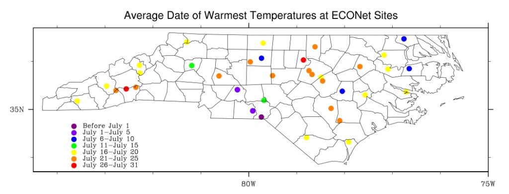
As far as how these dates correspond to what we see with our ECONet stations, we looked at daily maximum temperatures for the past 10 years, or period of record (whichever is shorter). What we found is that while NCDC claims our warmest day should occur between July 11 and July 15, the ECONet stations average their warmest days around July 19.
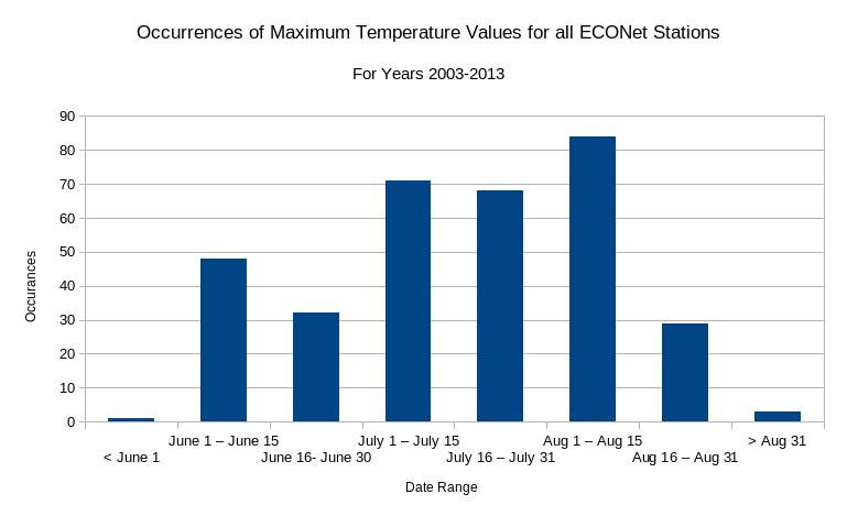
The majority of our ECONet stations see their warmest day between July 16 and July 25. In fact, only two of our stations (Jackson Springs and Taylorsville, the green dots on the map to the left) see their warmest day between July 11 and July 15. While the average is around late July, the majority of occurrences happen in early August (see the chart below).
While this period of record is considerably shorter than the one NCDC used to make their calculations, it is interesting to see that according to our stations the warmest days of summer are still right around the corner.
