Snowy Weather but Typical Temperatures for February
Monthly statistics for February 2014:
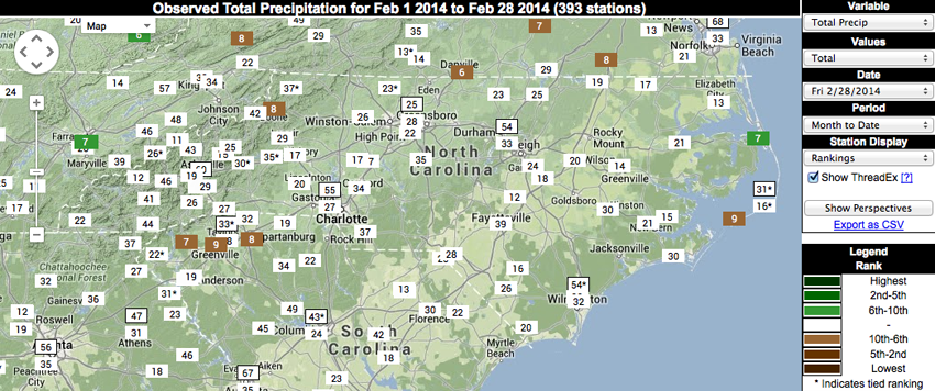
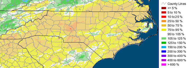
Statewide Average Precipitation: 3.27 inches (42nd driest since 1895)
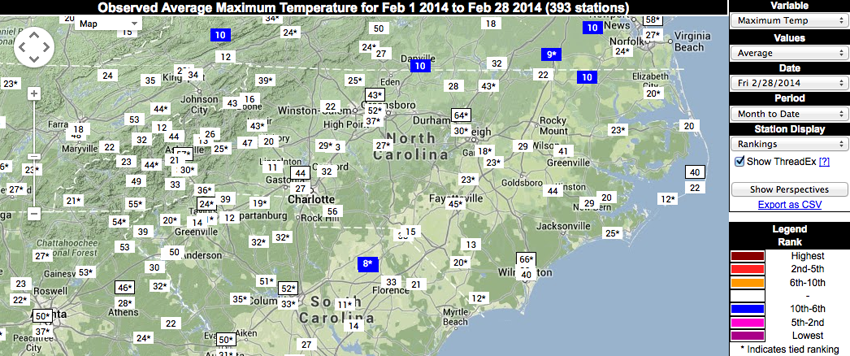
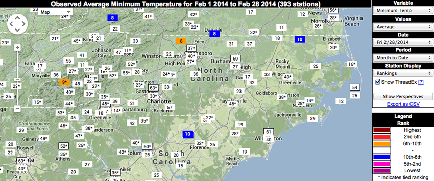
Statewide Average Temperature: 42.12°F (60th warmest / 61st coldest since 1895)
* Values generated from preliminary numbers
Believe It or Not, February was Near-Normal!
Many reading this will have the mid-February wintry event — and even the plunging temperatures and subsequent ice storm that occurred last week — on their minds and expect the February numbers to show the month was unusually cold. However, long-term temperatures recorded for North Carolina suggest last month was quite normal. Statewide averages ranked February 2014 right in the middle of the distribution since 1895, with nearly half of the Februarys being warmer and half being colder than this year. In comparison to some winters — especially over the past 25 years — February 2014 was a bit on the cold side. But last month’s values don’t come close to the cold February temperatures observed during the 1960s, 1970s, and early 1980s.

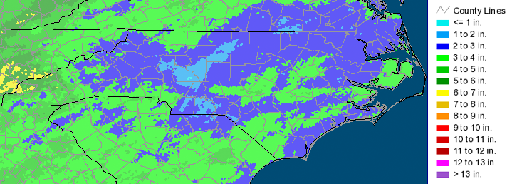
Despite Some Snow, Limited Liquid Precip. Totals
Precipitation wasn’t a big story for last month either. Despite several snow events, the statewide average precipitation in February was near normal, if a bit on the dry side. Note it takes a lot of snow to make 1 inch of liquid precipitation (between 5 and 15 inches, depending on the snow’s density). Two locations ranked last month in their top 10 driest Februarys on record (Boone and Ocracoke). However, neither of these stations have a long period of record, which means these numbers are not as robust as a station with, say, 100 years of data. Manteo actually observed it’s 7th wettest February on record, but as with the locations previously mentioned, this station also has a relatively short history.
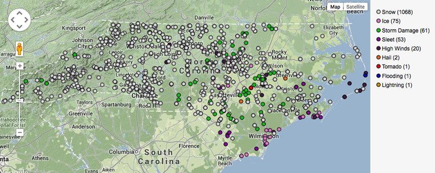
More Snow, More Ice… and a Tornado!
Winter weather dominated in terms of storm reports last month, however some spring-like weather crept in as well. On February 21, a line of severe storms moved across the state, bringing high winds, hail, and even a tornado to parts of the Piedmont and Coastal Plain. Most of the damage reports for this storm were associated with trees falling across roads and power lines, along with some structural damage, as a result of the high winds, which gusted from 30-40 miles per hour across most areas east of I-95.
Where’s the Drought Update?
Long-time readers may be wondering why we haven’t included a drought update at the bottom of our climate summary posts for the past couple of months. The reason? There is no drought! With the wetter weather we’ve been experiencing lately, we hopefully won’t be talking about drought for a while.
- Categories:


