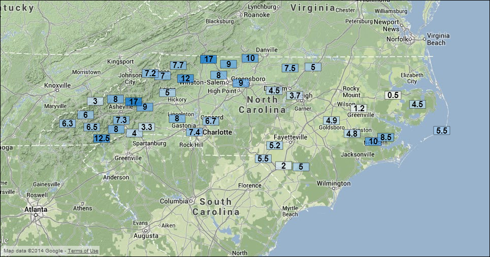
Winter’s latest chapter in North Carolina was the longest and most eventful of the year, bringing the suspense of precipitation type transitions, the fears of freezing rain and power outages, and the drama of gridlock caused by snowy roads. Here’s a summary of how the event unfolded, including a map of three-day snow totals.
The Setup
The story of this storm begins with a high pressure system over the midwest earlier in the week. After bringing single-digit temperatures to that region, the high slid to the east, eventually delivering its cold air down the east coast in the familiar cold air damming or “Appalachian wedge” pattern.
On Tuesday (Feb. 11), an upper-level disturbance moved over the Southeastern U.S., triggering precipitation stretching from the Gulf coast through North Carolina. The southern tier of NC saw snow for much of the day, and some heavier bands brought impressive accumulations: Parts of Jones and Pamlico counties came away with as much as 10 inches. South of there, locations from Morehead City through Wilmington received freezing rain, resulting in an icy landscape along the coast.

The Storm
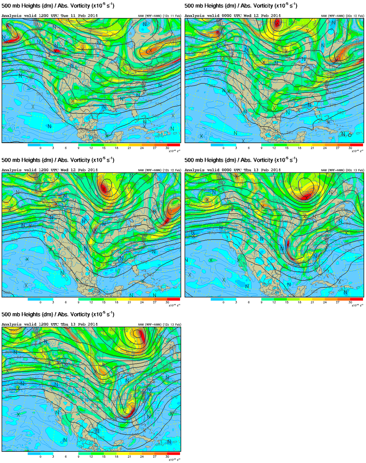
For most of the state, the bulk of the precipitation did not arrive until Wednesday, and the setup was more complex for this part of the event. The high to our north was still in place but began to slide offshore, meaning the eastern counties had above-freezing surface temperatures and would see freezing rain and rain instead of additional snow. A disturbance in the northern branch of the jet stream dug to the south and combined with a southern stream disturbance, which helped strengthen a surface low that moved from the Gulf of Mexico to the Atlantic, consistent with the classic Miller type A storm setup.
Precipitation began falling as snow on Wednesday (Feb. 12) around 9 a.m. in the southern Piedmont, and after noon in the northern counties. The precipitation rates and air temperatures in the mid-20s meant that once the lowest part of the atmosphere saturated, the snow quickly began to accumulate at an inch per hour in some places. Those snow rates — plus a rush of people hitting the roads to head home — resulted in widespread gridlock, traffic accidents and abandoned cars that afternoon.

More than four inches of snow fell in Charlotte, the Triad and the Triangle before the transition to sleet began. The transition happened in Fayetteville by 1:30 pm, Charlotte by 3 pm, Raleigh by 4:30 pm, and Greensboro by 7 pm. A few hours later, most of those locations changed to freezing rain. That gave an additional glaze of a few hundredths of an inch in the Triad, about a tenth of an inch in Charlotte, and nearly a quarter inch in the Triangle and Fayetteville.
As the back edge of the system moved through on Thursday, a final round of precipitation fell, mostly as snow, across the Piedmont. As the deformation band — a zone of enhanced lift and heavier precipitation — rotated across the region, Mount Airy picked up an extra 6 to 8 inches of snow, the Triad saw another 2 to 3 inches, and the Triangle saw less than an inch fall on top of the existing snow, sleet and ice.
The Results
All told, the greatest snow totals were in Surry and Yadkin counties in the Foothills, where Thursday’s snow band brought overall accumulations to more than one foot. Some spots near Mount Airy saw as much as 20 inches, according to snow totals from the NWS Blacksburg office. As the map below shows, Charlotte reported just over 7 inches for the storm, the Triad finished with 6 to 10 inches, and most of the Triangle had 3 to 6 inches.

Over the three-day period from Tuesday through Thursday, almost all of the state except the northeastern coast — the region that had the most snow on January 28 — saw snow at some point, making this our most widespread snow event since December 25-26, 2010. Initial forecasts suggested similar impacts to the crippling December 2002 ice storm, but fortunately, ice accumulations were generally lighter than expected and power outages were comparatively limited, primarily affecting the southeastern counties.
For Miller type A events like this one, we often see either rain or snow, and rarely such a mixed bag of precipitation. In this case, the mix of snow, sleet, freezing rain, and rain was a consequence of the position of the high to our north and some warm air sitting just above the surface cold dome. A similar event unfolded in late January 2010, when snow switched to sleet across much of the Piedmont, and freezing rain plagued the inland corridor of the Coastal Plain.
While we can’t yet close the book on winter 2014 in North Carolina, this chapter was perhaps the most interesting and surprising one so far.