This is the first part in our four-part 2013-14 winter outlook series. The first two posts this year will look back at some memorable major snow and ice storms in North Carolina.
When it comes to major weather events, North Carolina is often known most for its hurricanes and springtime thunderstorms. However, our state is also rather unique because of the variety of winter weather it receives. Like our neighbors to the north, we see our share of snow. In more marginal events, it’s common to start as rain and transition to sleet or snow — the classic “wintry mix” scenario. And any seasoned winter veteran will tell you that you haven’t experienced a North Carolina winter until you’ve been through an ice storm. As we enter the winter of 2013-14, we wanted to take a look back at some of the more memorable winter storms and examine their causes and impacts.
The variety of winter precipitation types we receive is possible because of our geography and topography. We’re not so far south that it never gets cold enough for snow, or so far north that snow is all we see. Two nearby warm bodies of water — the Gulf of Mexico to our south and the Gulf Stream current in the Atlantic Ocean to our east — provide a favorable environment where storms can develop and intensify. Also, the Appalachian Mountains to our west help keep cold air in place during winter events. Although each storm behaves slightly differently, almost all of them rely on these three factors to bring us frozen precipitation.
Setup for a Snowstorm
Big snowstorms usually start taking shape a day or two ahead of time, when a low pressure system moves over the warm Gulf of Mexico and begins to strengthen. That was the case leading up to the storm on the day after Christmas in 2010. As the animated sea level pressure maps below show, during a 24-hour period, a weak low over southern Louisiana became a strong storm off the east coast.
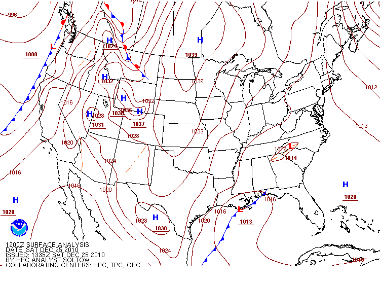
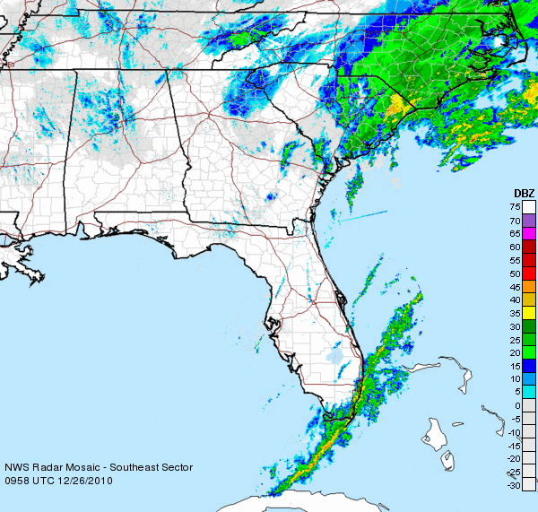
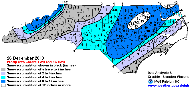
The Mountains and western Piedmont saw a healthy batch of snow earlier on Christmas day thanks to a weak lee-side trough that formed in the wake of the Appalachians. (This feature is signified as a low pressure area in the first few frames of the maps above.) After that, the coastal low approached, bringing plenty of precipitation along with it. It began falling as light rain across the eastern part of the state on Christmas afternoon before transitioning to all snow as temperatures dropped to near-freezing and below. The storm moved up the east coast quickly, but not before leaving up to a foot of snow along the I-95 corridor of the east coast.
The basic setup responsible for this event, sometimes called a “Miller type A” pattern, has been the source of many of our major snow events, including the storms in January 2000 and January 2002 that left the eastern Piedmont buried under more than a foot of snow.
An Ice Storm and its Impacts
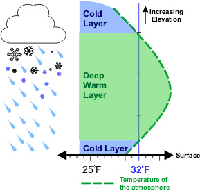
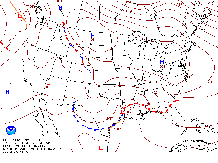
Prior to big ice storms, we usually have what meteorologists call a “cold air damming” event. This happens when a strong high pressure system to our north funnels cold air to the south, as was the case leading up to the December 2002 ice storm. The mountains act as a dam to trap the cold air near the surface across much of the state. Critically, the air just above this shallow cold wedge is much warmer (as the figure on the right illustrates), so precipitation falling from the cloud melts before becoming super-cooled (below-freezing) liquid droplets in the cold air near the surface. These droplets then freeze on contact with the surface.
Meanwhile, two separate low pressure systems tend to develop: one off the coast, and one farther inland, as the animated loop of sea level pressure analyses below shows. This is the defining characteristic of what we call a “Miller type B” pattern. The interplay of these two lows creates precipitation across the state. If the warm layer aloft is not very deep, precipitation may begin as snow or sleet, but it eventually transitions to the dreaded freezing rain that often results in icy roads, fallen trees, and widespread power outages.
For more about past winter storms, be sure to check out our Winter Storm Database, which is a catalog of North Carolina’s winter events over the past 50+ years. In our next post, we explore these past events to determine just how frequently major winter storms occur in North Carolina, and answer some frequently asked questions about these big events.