Monthly statistics for November 2013:
Statewide Average Precipitation: 3.84 inches (34th wettest since 1895)
Statewide Average Temperature: 47.32°F (26th coldest since 1895)
* Values generated from preliminary numbers
November Brings a Cold, Dry End to Autumn
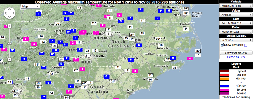
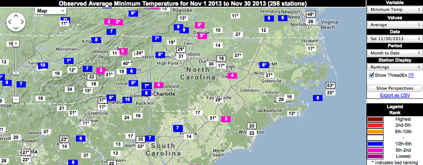
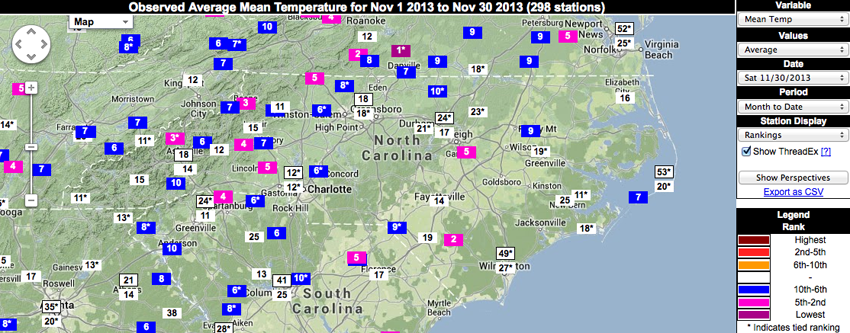
Temperatures in November were cold — maximum, minimum and mean daily temperatures ranked in the top 10 coldest on record for many reporting sites in North Carolina. Statewide average temperatures available for the past 119 years ranked November 2013 below the 25th percentile, but no monthly records were set this month. In comparison, the statewide average temperature for November 1901 was 43.16°F, ranking that month as the coldest November on record. November 1985 was the warmest on record, with a statewide average temperature of 58.78°F.
One benefit from the cold weather: several ski resorts are reporting they are ready for business with most or all slopes open.
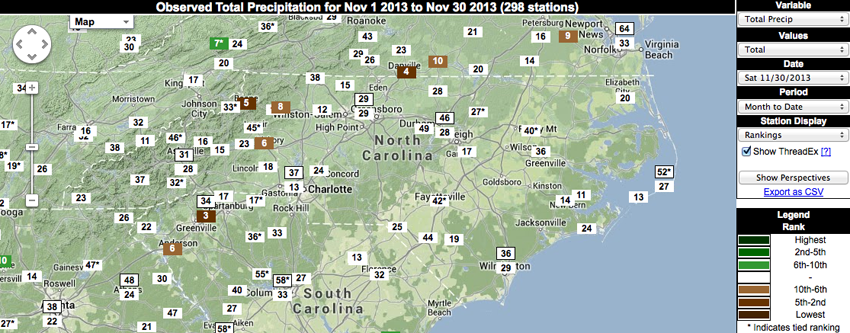
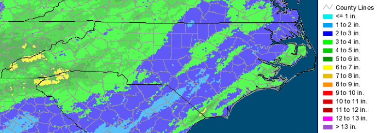
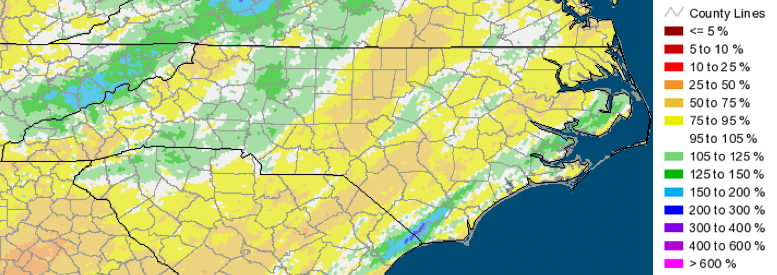
Limited Precipitation Outside the Foothills
November was generally a dry month. Much of the state received below-normal precipitation, and most that fell came from a single, large storm just before the Thanksgiving holiday. The western half of the state received the most precipitation, which came in both liquid and frozen forms. Amounts in excess of 3 inches were widespread across the Foothills, but nearly the entire state reported at least 1 inch of precipitation from this one storm.
While November 2013 was a dry one, the statewide average precipitation for the month (3.84 inches) was actually a bit on the wetter side compared with other Novembers throughout the full 119 year history. The driest November was in 1922 when 0.62 inches fell. The wettest November was in 1948 when 8.92 inches was reported in statewide averages.
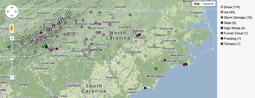
November brought an early taste of winter for much of central and western North Carolina. The large storm that brought several inches of rain to much of the state also produced snow, sleet, and freezing rain for many locations. This storm also produced a waterspout near Morehead City that moved onshore as an EF-2 tornado and damaged structures in Atlantic Beach.
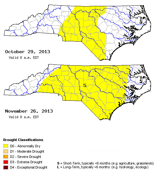
There aren’t many impacts from the dry weather, but we did observe less water in the streams and lower input into our surface reservoirs than is typical for November. As a result, D0 (Abnormally Dry) conditions expanded in November to cover much of central North Carolina.