March was Cold and (Mostly) Dry, with Some Late Season Snowfall
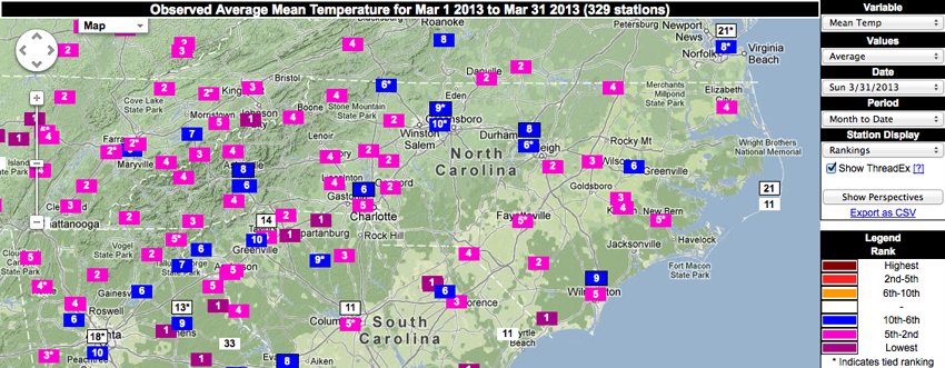
March 2013 was a cold one! Not only did the statewide average temperature for the month rank it as the 6th coldest March on record, that value was roughly 0.3 degrees lower than in January — typically the coldest month of the year for North Carolina, on average.
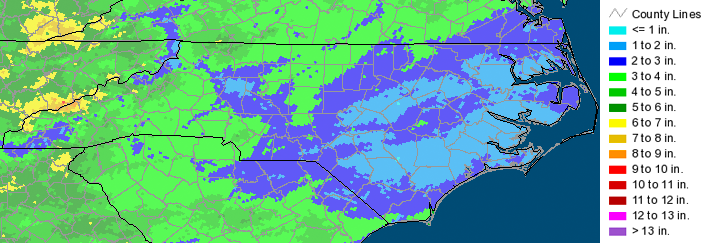
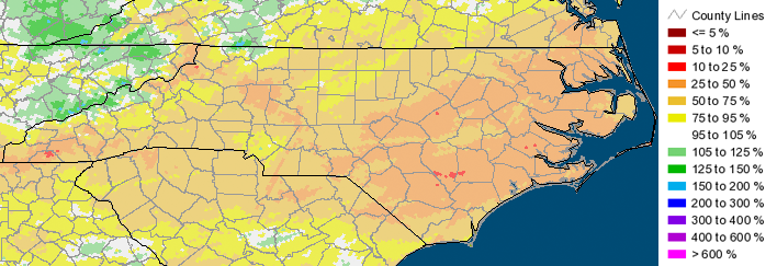
Statewide Average Precipitation: 2.85 inches (22nd driest since 1895)
Statewide Average Temperature: 43.6°F (6th coldest since 1896)
Monthly average temperatures for several stations ranked in the top 5 coldest, including stations in Murphy, Cleveland, Concord, Statesville, Yadkinville, Clayton, and Elizabethtown — all of which ranked 2nd coldest for each station’s period of record. In addition, average temperatures in March were the coldest on record for a station in Longwood, as well as for a few other stations near the state’s border with South Carolina and Tennessee.
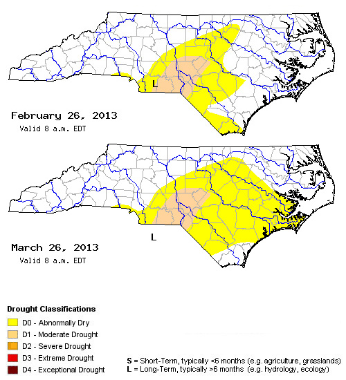
Dry conditions persisted across most of North Carolina last month, with the eastern half of the state seeing the least amount of rainfall. March 2013 ranked in the top 5 driest on record for stations in Elizabeth City, Greenville, Kinston and New Bern. In addition, a few areas in southern Sampson County and eastern Duplin County observed only 10-25% of normal precipitation for the month. The western half of the state mostly observed precipitation amounts in the normal range, with a few areas in the mountains receiving above normal rainfall.
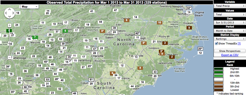
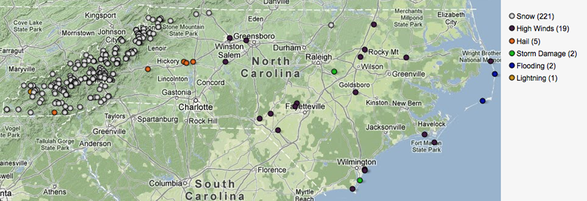
A few late season storms brought winter precipitation to the mountains of NC, with some areas reporting 3-5 inches of snow with the system that moved through on March 26. The central and eastern parts of the state were relatively quiet, with a few reports of high winds and minor storm damage on March 6 and March 24.
Impacts to Agriculture and Water Resources
March consisted of less rainfall across the state compared to February, giving grain growers the time to apply fertilizers and herbicides to their crops. However, the cooler temperatures observed throughout the month painted a less positive picture. Planting for many crops such as corn was delayed due to the cooler temperatures, which also hindered the development of winter wheat in some areas. Colder than normal temperatures also resulted in the late blooming of peaches, and required the need for frost protection multiple times throughout the month.
Streamflow values in March mostly hovered around normal, with the exception of areas in the Neuse, Tar-Pamlico and White Oak river basins that observed below-normal streamflows. Given that precipitation amounts were generally 10-50% of normal over the eastern half of the state, abnormally dry conditions became more widespread over these areas.
- Categories:


