Although our winter just ended, the weather conditions half a world away in the western Pacific Ocean may already be shaping how our next winter will turn out.
Yes, December is still seven months away, but an analysis of years that developed a wintertime El Niño pattern — which often leads to cooler and wetter conditions in North Carolina — shows that many of those patterns began to emerge in the spring of the previous year.
The graph below shows 16 years that began in a neutral or La Niña phase but evolved to an El Niño event by the next winter. Individual years are shown in gray, while the average of all years is shown in blue. The y-axis shows the Oceanic Niño Index (ONI), which is a measure of the sea surface temperatures in the central Pacific Ocean. The x-axis shows the ONI, running from one December-January-February (DJF) period to the same period the next year.
There is a lot of good information on this graph, but let’s make two main observations:
- Developing El Niño events begin to show up as warmer-than-normal sea surface temperatures (positive ONI values) during the March-April-May period, on average.
- All of these events reached El Niño “status” (with ONI values > 0.5) by the end of the summer, so if we’re not in the El Niño phase by the start of fall, an El Niño event is extremely unlikely for the coming winter.
If you’re wondering what this means and why it matters, here’s an explanation, in Q-and-A form.
What causes an El Niño event to emerge, anyway?
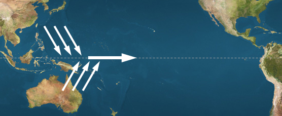
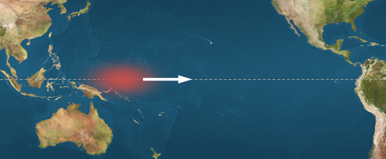
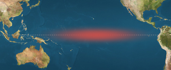
Not surprisingly, the origin of El Niño events is linked with oceanic and atmospheric patterns in the equatorial Pacific region. Research done at the University of Hong Kong connected the formation of El Niño events with the strength of two monsoon patterns in the western Pacific. The diagrams below show this process step-by-step.

How does this compare with the timing of emerging La Niña events?
La Niña events that evolve from neutral or El Niño conditions typically emerge later in the year than their counterpart emerging El Niño events. The graph below shows the 11 such years since 1950, along with their average in blue. From this we can see that these La Niña winters typically emerge as below-average sea surface temperatures (negative ONI values) in the late spring (April-May-June), typically not reaching La Niña status until the summer or fall.
Why don’t El Niño events emerge later in the year?
There are two main reasons for this. First, it seems that El Niño events typically emerge earlier in the year because their development is tied to the western Pacific monsoons that typically occur during the winter or spring. Also, remember that El Niño events are characterized by warmer water in the central Pacific, and that warm water is driven there from the western Pacific by large-scale westerly winds. The western Pacific Ocean near the equator is warmest in the spring and cools as the summer goes on, so if the westerlies didn’t “kick in” until later in the year, they would only be pushing slightly warm water to the east, which would develop just a weak El Niño, at best.
How does this relate to the current pattern?
We are currently in a neutral ENSO phase, and since 1950, neutral winters have been followed 8 times by another neutral winter, 8 times by an El Niño winter, and once by a La Niña winter. If we are going to go to El Niño, though, we are in the crucial period for development.
In January, there was no real sign of northerly flow developing in the east Asian monsoon region:
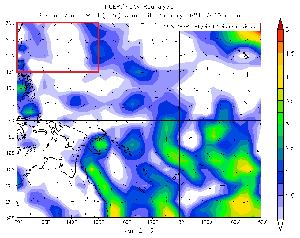
And in April, we did not observe any anomalous southerly winds in the Australian monsoon region:
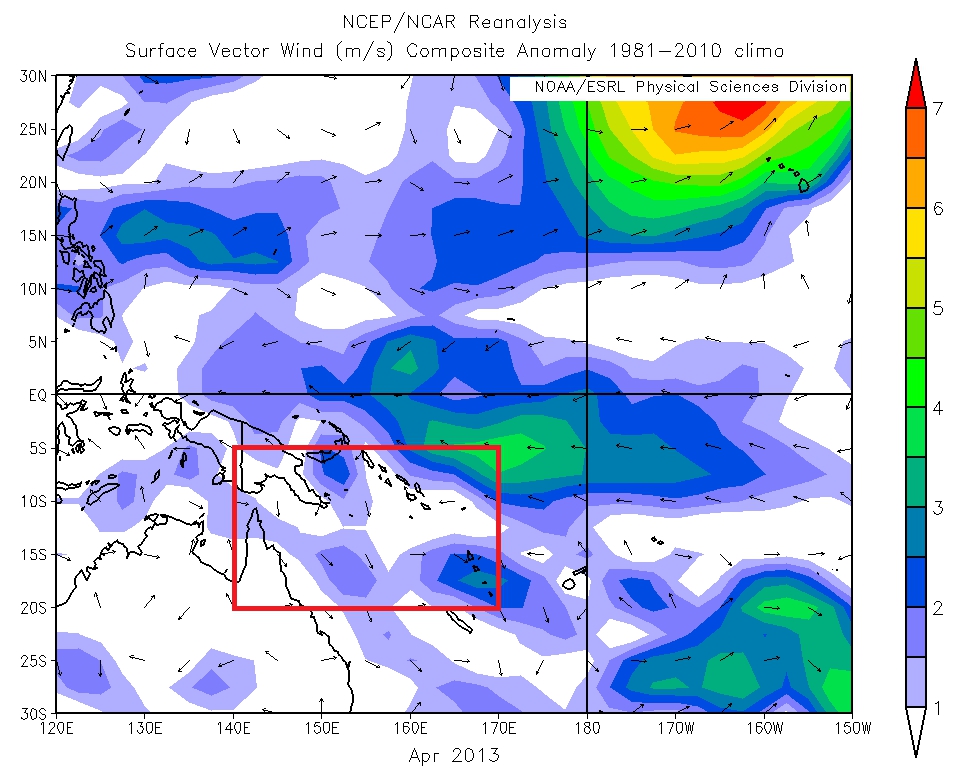
Both of those would seem to indicate that an El Niño pattern is not currently developing in the Pacific, which agrees with most of the current computer model forecasts for the next 12 months. Of course, an El Niño signal could still emerge this summer, but the early indications seem to favor another neutral winter next year.
Sources:
- The Role of the Asian-Australian Monsoon System in the Onset Time of El Niño Events by Jianjun Xu and Johnny Chan, 2001, Journal of Climate
- A relationship between timing of El Niño onset and subsequent evolution by Takanori Horii and Kimio Hanawa, 2004, Geophysical Research Letters