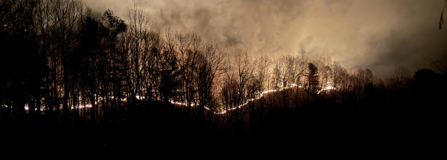
On the fast track into spring, March remained mostly warm in North Carolina, with dry weather especially in the west. Low humidity, gusty winds, and ongoing drought combined to fuel more wildfires across the state.
Warm Days with Few Cold Nights
The spring-like warmth that settled in by late February stuck around in March, making it a warmer-than-normal month overall. The National Centers for Environmental Information (NCEI) reports a preliminary statewide average temperature of 53.3°F and our 23rd-warmest March on record since 1895.
Locally, it was one of the top ten warmest Marches on record at a number of long-term weather stations. Raleigh and Lincolnton each had their 5th-warmest March on record, while it was the 6th-warmest in Hickory, the 9th-warmest in Elizabeth City and the 10th-warmest in Greensboro.
The warmest days were a pair of Wednesdays in the middle of the month. With high pressure positioned to our south on March 12 and March 19, high temperatures reached the low 80s across much of the state. That was a far cry from the consecutive snowy Wednesdays back in March 1960.
On March 19, parts of far western North Carolina became the hottest parts of the state not just on that day, but for the entire month. A feed of warm, dry air from the south descended down the mountain slopes and into the valleys of Madison County, where high temperatures hit 85°F in Marshall and Hot Springs.
To put into perspective how warm we were during this stretch, those afternoon highs in the Mountains were more typical of late June, and the nighttime low temperature of 63°F on March 16 in Raleigh was as warm as the normal high temperature for that date.
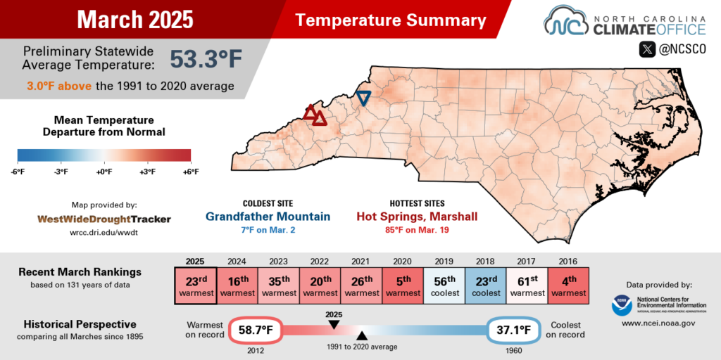
But true to the month of March – much of which is part of astronomical winter – there were some cool nights mixed in as well. On March 19, Charlotte had a morning low of 38°F before rocketing to 81°F that afternoon; the 43-degree swing that day was tied for the 7th-greatest daily temperature range on record there.
While there were some cool nights, there were few cold ones in most areas. The two nights with temperatures at or below freezing in Greenville tied for the 7th-fewest in March out of the past 94 years, while Raleigh had only one sub-freezing night all month on March 3.
If we don’t see an April chill, then that will be the 2nd-earliest last spring freeze on record in Raleigh, behind last year’s February 21 freeze. It’s also more than a month earlier than the local average last freeze date of April 8.
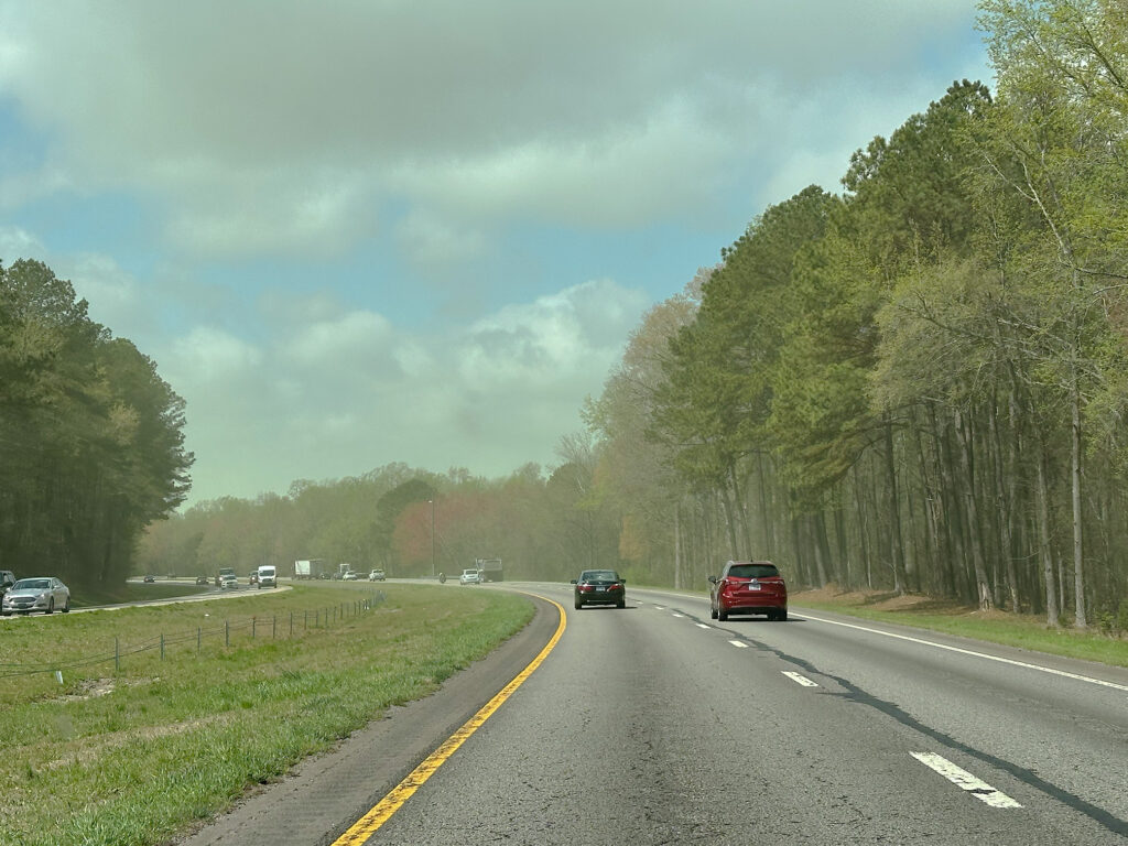
Thanks to the overall warm temperatures, plants produced plenty of pollen last month, and with breezy weather to scatter it and few rainy days to settle it, the dust-like spores were out in record numbers.
By March 28, grass pollen – which typically peaks in May – reached High levels as measured by the NC Division of Air Quality’s Pollen Lab in Raleigh. With a count of 21 grains per cubic meter, it was the highest grass pollen level recorded in March dating back to 1999, per their Pollen Trends Report tool.
And on March 31, tree pollen hit Very High levels for the first time this year, with the classic yellow pine pollen being the leading contributor amid this sneezy season.
Drought and Impacts Emerge in the West
An overall dry pattern, only briefly broken for some eastern areas in the middle of the month, left most of the state with below-normal precipitation in March. According to NCEI, the preliminary statewide average precipitation was 2.64 inches, which ranks as the 18th-driest March out of the past 131 years.
The old saying that March comes in like a lion certainly held true this year. During the first week of March, we saw extreme fire danger, severe weather including an EF-1 tornado in Union County on March 5, and even light snow in the Mountains on the backside of a strong cold frontal passage.
After that, most areas waited almost two weeks until the next round of rain on March 16 and 17. That event, also associated with a frontal system traversing the state, again included severe impacts, with tornado touchdowns along the coast in Pender and Perquimans counties.
That system also brought locally heavy rainfall in parts of eastern North Carolina. Areas along Interstate 95 picked up more than three inches of rain, including a daily total of 4.70 inches in Roanoke Rapids on March 17: the wettest single day there since October 9, 2016, during Hurricane Matthew.
The month ended with minor rain events generally totaling a half-inch or less on March 20, March 24, and March 31, with the latter event also bringing some gusty winds that downed trees in the Triangle and areas to the northeast.
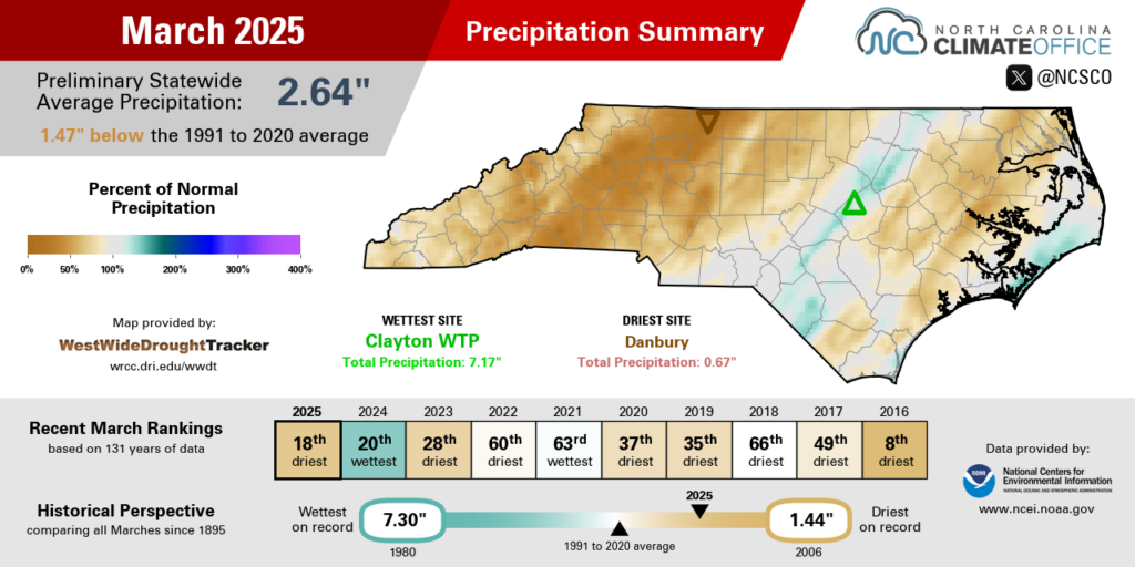
For some eastern areas, the mid-month heavy rains helped them finish slightly wetter than normal for the month. Fayetteville was 0.15 inches above normal in its 46th-wettest March on record, Lumberton was 1.28 inches above normal in its 29th-wettest March out of 115 years with observations, and Beaufort had its 3rd-wettest March in the past 25 years.
On the heels of our dry winter, those spring showers helped stabilize and even improve conditions in parts of eastern North Carolina. Streamflows in the northern Coastal Plain returned to near normal levels, and the wide swath of Severe Drought (D2) along the southern coastline was reduced to just a pocket in Pender and Onslow counties.
It was a different story farther west, where precipitation was much more limited last month. It finished as the driest March on record in Danbury dating back 78 years, and it ranked as one of the top three driest Marches at sites including North Wilkesboro (2nd-driest in 102 years), Lenoir (2nd-driest in 134 years), and Pisgah Forest (tied for 3rd-driest in 85 years).
In that part of the state, Moderate Drought has expanded amid declining streamflows, emerging ag impacts such as 42% of topsoil moisture rated as short or very short and 22% of oats in poor or very poor condition per USDA/NASS, and large wildfires across the landscape, including on rugged terrain strewn with debris from Hurricane Helene last fall.

Dry, Windy Weather Fuels Fire Danger
The lack of precipitation and post-hurricane fuel loading weren’t the only factors ramping up our fire danger last month. Dry and windy weather also helped fires ignite and expand.
Based on the average relative humidity, it was the least-humid March on record in Charlotte, Greensboro, and Raleigh, with less than 50% humidity at all sites – an exceptionally low value in this notoriously muggy part of the country.
Using back trajectories from NOAA’s HYSPLIT tool, we can see that the air reaching western North Carolina on the evening of March 18 – just before one of our major wildfire outbreaks began – was over Nebraska only 48 hours earlier. That region is also in a drought, and with no major moisture sources between there and here, the air was bound to be dry when it arrived.
In addition, that air descended by almost 2,000 meters – or about 6,500 feet – in elevation on its way to us. Sinking air warms while the dew point stays about the same, which lowered the humidity level even more.
Locally, with low soil moisture levels due to our own drought and limited green-up across western North Carolina at this point in the season, there has been little evaporation from soils and vegetation to boost atmospheric moisture levels.
And windy days – another consequence of the strong cold frontal passages that dragged in dry air masses – have further sapped the moisture content. Based on the monthly average wind speed, this was the windiest March in Charlotte since 1994, and the windiest in Greensboro since 1996.
Warm, dry, and windy weather are all key ingredients for wildfires to develop and spread, so it’s not surprising that it was an active month. The North Carolina Forest Service reports a preliminary total of 1,846 fires – the most in March since 2006 – burning 17,841 acres on state-owned and private lands last month.
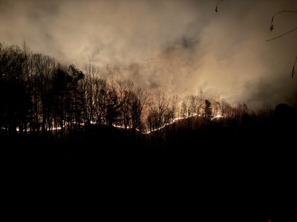
We saw how quickly that activity escalated after one of those mid-month frontal passages. Afternoon relative humidity values on March 19 dropped below 25% across much of the state. That helped the two large, 2,000+ acre wildfires in Polk County start and spread, with the cause of the Black Cove fire determined to be a downed powerline that may have also been wind-related.
The following day, sustained winds at our ECONet station on Bearwallow Mountain reached up to 65 mph – the second-highest recorded March wind speed at that location out of the past 25 years. Such strong winds can cause fires to spread uncontrollably, especially in often inaccessible mountainous areas.
That chaotic weather and abundant fire activity that was already stretching response resources to its limits led to the implementation of a statewide burn ban on March 21. That ban was lifted on April 2, although caution is still encouraged when burning outdoors, particularly while we wait for some of April’s signature showers to potentially provide drought relief.
