The third significant winter storm of the season across the state brought a mixed bag of precipitation and bumped up the seasonal snow totals for some sites.
Following mid-January’s snowstorm in the west and an eastern snow event later that month, this storm produced statewide impacts but varied precipitation types, ranging from all rain in the south to all snow in the north with a mix of sleet and freezing rain in between.
The storm took shape on Wednesday morning as a low-pressure system formed to our south, while a weak high-pressure system over the mid-Atlantic states funneled in cold air from the north.
With surface temperatures ranging from the upper 20s to the low 40s, precipitation began falling as snow in the northwest and rain in the southeast, and it largely stayed that way through the duration of the event on Wednesday.
The storm system shifted offshore by Wednesday afternoon, so the bulk of the moisture stayed to the east. That meant areas along the northern coastline saw the highest totals in the state for the second time this winter.
From Snow to Rain in Eastern NC
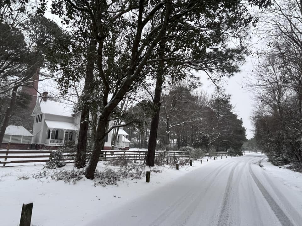
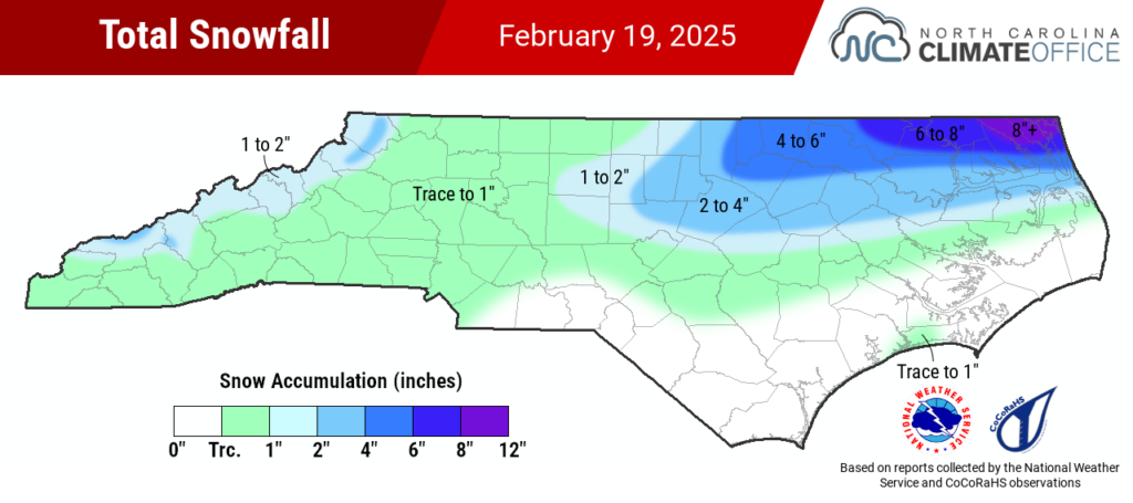
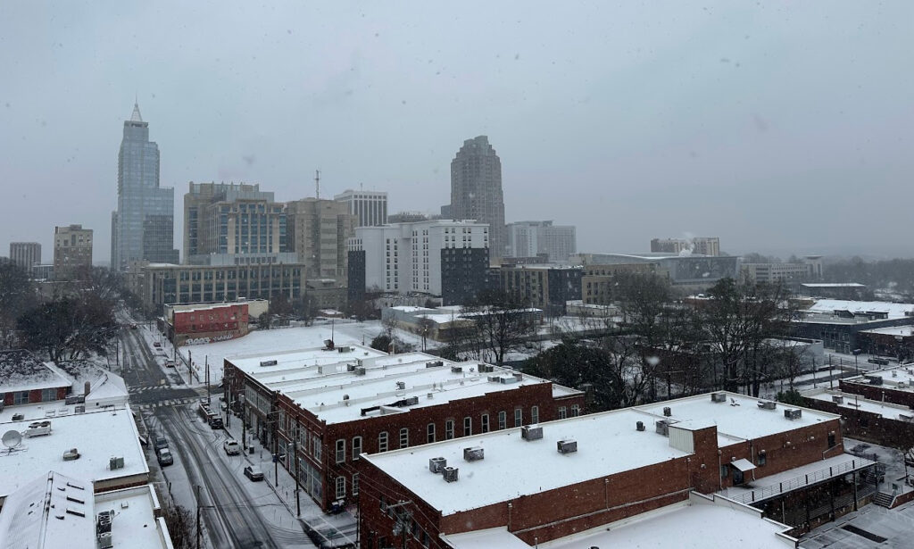
In the northeastern Piedmont, it was a solid snow event with several inches on the ground. For areas such as Raleigh (2.3 inches) and Henderson (4.0 inches), it was the greatest single-day snowfall in almost five years, since February 20, 2020.
In the far northeastern corner of the state, more than eight inches fell in areas near the Virginia border. Snow reports from the National Weather Service office in Wakefield show 11 inches in Moyock and 9 inches in Waterlily and Burnt Mills.
CoCoRaHS observations in southern Pasquotank County show more than six inches fell south of Elizabeth City, while areas along the northern Outer Banks such as Kitty Hawk and Kill Devil Hills saw 2 to 4 inches from this storm, adding to their more than six inches from last month’s event.
Farther south, those falling flakes melted in the warmer mid-levels of the atmosphere, causing a transition to sleet or freezing rain by the time they reached the colder air near the surface.
Reports collected by the National Weather Service office in Morehead City note ice accumulations of up to 0.3 inches in Lenoir County and a quarter-inch in parts of Beaufort, Craven, and Martin counties. That led to some broken tree branches and several thousand electrical customers without power in the central Coastal Plain.
In the southeast, areas such as Wilmington saw mostly rain with a brief changeover to freezing rain on Wednesday evening. While this event didn’t deliver the same snowy surprise as in January, it did offer up to half an inch of liquid precipitation to help alleviate ongoing drought impacts, including low streamflow levels and dry soils along the southern coastline.
More Snow in a Busy Season
This storm and this season will long live in the memories of residents of northeastern North Carolina, where they’ve now had two big snows in the span of a month.
A number of sites are sitting well above their normal annual snowfall, which is only half an inch to two inches in much of that region. With 4.5 inches on January 22 and 2.5 inches on Wednesday, Edenton is now up to 7 inches for the season – more than triple its normal annual snowfall of 2.3 inches.
We’re still awaiting the official report from Elizabeth City’s observing station, but nearby reports suggest at least six inches fell there, adding to the 4.9 inches last month to put them over 10 inches this winter.
Along with the locally heavy totals, this event stands out for its timing quite late in the winter season. During our recent string of spring-like Februarys – seven of the past eight have been warmer than normal – any snow has been hard to come by at this time of year.
In fact, this is only the fourth significant statewide wintry event in the month of February during the past ten years, joining the back-to-back snows on February 23-24 and 25-26 in 2015, plus the light snow on February 20-21, 2020, that also brought the highest totals to northeastern North Carolina.
And after two consecutive snowless winters across much of the state, this event has given a bit more accumulation to cap off an active season. The three measurable snows in Raleigh is the most since five snow events there during the winter of 2017-18.
That winter seven years ago was also the last with above-normal snowfall in Raleigh, but barring another late-season snow, this winter won’t have the same outcome. Despite multiple snow events, accumulations have been relatively light with each, limiting the totals so far this season across the Piedmont.
After just 0.2 inches in Wednesday’s storm, Charlotte has totaled 1 inch for the winter, compared to its normal of 3.5 inches. Greensboro picked up half an inch from this storm to move up to 3.4 inches for the season – about half of its normal 7.1 inches. Raleigh’s seasonal total now stands at 4.5 inches, but that’s still shy of its normal 5.2-inch amount.
No matter the amounts, this has been a winter to remember as snow returned after a nearly three-year absence. And this event has solidified it as a season for the ages in one corner of the state, which has seen a rare double dose of snow just a few weeks apart.