Florence After Five: An Anxious Arrival

This is the first in a four-part blog post series remembering Hurricane Florence for its five-year anniversary.
Within arm’s reach on the desk of Steve Pfaff, the warning coordination meteorologist at the National Weather Service office in Wilmington, is a printed map graphic.
At first, it’s unassuming – weather maps are hardly out of place in a forecast office, after all – but upon closer examination, its significance is clear.
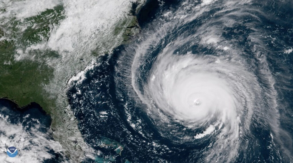
It’s the first forecast briefing his office issued about Hurricane Florence from September 6, 2018. At the time, Florence was halfway across the Atlantic, having just weakened from Category-4 strength down to a Category-2, and it was more than a week away from a potential landfall.
But still, the briefing cautioned that “all interests in the Carolinas should closely monitor the progression of Hurricane Florence,” despite the uncertainty about what impacts – if any – it might have on the state.
In hindsight, that map is a memento of Pfaff’s role as a trusted information provider during the costliest and most devastating hurricane in North Carolina’s modern history. It’s also a reminder of just how bad things were about to get five years ago.
Not Just Another Hurricane
After that briefing was issued, the next eight days before landfall, plus four more in which Florence crawled across the Carolinas and dropped record-breaking rainfall amounts approaching three feet, were on one hand painfully slow and on another hand a blur.
“It was fast and furious early on with the decision support and the briefings we were doing,” said Pfaff, reflecting on Florence five years after the fact.
For forecasters, those early days were complicated by the dynamic nature of the storm. By September 7, Florence was downgraded to a tropical storm after being shredded by wind shear over the central Atlantic. Three days later as environmental conditions became more favorable, the storm underwent rapid intensification from a Category-1 to a Category-4 in less than 24 hours on September 10.
With the storm’s trajectory putting it on a direct path toward our coastline, forecasts began to focus on the potential impacts of a major hurricane making landfall – on par with Fran in 1996 or even Hazel in 1954.
But more subtle aspects of the storm and its surrounding environment were also shaping its eventual impacts.
First, there was the unusually high latitude at which it approached. Instead of tracking from the south through the Bahamas like Floyd, Matthew, or many other storms that eventually reach North Carolina, Florence approached from the southeast, nearly perpendicular to our southern coastline.
“I don’t recall ever seeing anything come at us from that direction,” said Pfaff. “When it comes to analogs, we were basically out in left field.”
That was part of Florence’s rarity, taking a track that few to no historical storms had traveled en route to North Carolina. And because of that motion, it was barreling head-first into a roadblock.
With high pressure building to our north, east, and west, Florence would effectively be boxed in once it reached our coast. Instead of having an easy escape route like most storms – such as Floyd, the remnants of which were over New England less than 24 hours after its landfall in North Carolina – Florence would be a slow-moving, rain-dumping, wind-whipping menace staying with us for days.
“With the projections of it slowing down, I remember just shaking my head as the actual forecast amounts kept going up,” Pfaff added.
Updated forecasts also showed Florence weakening prior to landfall. While that was good news in terms of its potential damage, it also created a false sense of security that added an extra challenge for communicating the storm’s hazards.
“I distinctly remember the messaging changing once it became clear this thing wasn’t going to blow through here, since we started emphasizing life-threatening flash flooding,” said Pfaff.
“This wasn’t going to be just another hurricane. People are going to die as a result of this because we haven’t seen anything like it before.”
Forecasters Prepare
Those rainfall forecasts showing widespread totals of more than 20 inches, and localized amounts exceeding 30 inches, may have seemed impossible or overblown to some, but for meteorologist Mark Bacon at the Wilmington office, they couldn’t be discounted.
“To me, they were surprisingly believable because when I think back to some of the top five rain events that we’ve had – October 2015, Matthew, Floyd – we’ve seen many double-digit and even some 20-inch rainfalls,” said Bacon.
“We get them here. With a legitimate hurricane stalling for 24 hours or more, it seemed believable.”
On the heels of Hurricane Harvey, which dropped more than 60 inches of rain over Texas in 2017, totals half as high seemed more than possible in North Carolina.
With such a dire forecast, even inland offices like the National Weather Service in Raleigh couldn’t ignore the potential impacts from Florence, especially given our recent hurricane history.
“It was that time of year when we’re kind of worried about storms anyway, and this was a couple years after Matthew, which made us anxious as well,” said Jonathan Blaes, the meteorologist in charge at NWS Raleigh. “We were anxious about the workload, along with knowing that there are some folks who can’t afford to deal with this again.”
As Florence closed in, local National Weather Service offices called in reinforcements. Barrett Smith is now the senior service hydrologist at the Raleigh office, but in 2018, he was working at NWS headquarters in Washington, DC. Smith and a former hydrologist from Vermont were both deployed to Raleigh to assist with the forecasts for Florence.
Even with extra personnel, the week surrounding Florence offered no time to relax.
“It was all hands on deck,” said Smith. “But we got ahead of a lot of the flooding. We were issuing near-record or major flood forecasts four or five days in advance.”
One particular challenge – and an eventual forecast success story – was the Fayetteville area along the Cape Fear River, which had flooded during Matthew and seemed likely to do so again during Florence.
Amid concerns that the river could crest at more than 70 feet, which would have required mass evacuations, the National Weather Service’s official forecast showed a crest of 62 feet: within a half-foot of what actually happened.
But beyond that forecast skill, there was plenty of coordination to thank as well.
“This was the first time I recall having an emergency manager from a county, the Southeast River Forecast Center, and the weather forecast office all talking about river flooding,” said Smith. “We do this with severe weather, we do this with winter weather, but this was the first time I ever recall talking about a river forecast three or four days in advance.”
That foresight would prove prescient given what was to about happen when the storm arrived.
A Long-Lasting Landfall
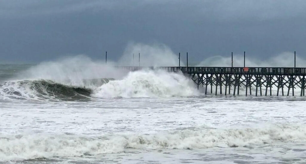
Florence’s eye moved over Wrightsville Beach just after 7 am on September 14. But the end of the storm’s trip across the Atlantic was just the beginning of the havoc it would unleash on North Carolina.
During those hours after landfall, the storm – by then, moving at just 3 mph – battered the southern coastline “like a buzzsaw,” Pfaff said, with both driving rainfall and steady tropical storm-force winds.
Its unrelenting nature meant calls for help during the storm were difficult to answer.
Pfaff recalls receiving a question from New Hanover County Emergency Management wanting to know when the eye would move over the southern part of the county so they could use that window to respond to the queue of dozens of 911 calls in that area.
“It made it real, in a sense, that outside of our brick building, there were a lot of people hurting,” he said.
And it wasn’t just that need for decision support that caused reality to set in. As roads became impassable due to flooding, forecasters were stuck at work for the duration of the storm.
At the Wilmington and Morehead City offices, when staff were off duty from their 12-hour shifts, they lived and slept in back rooms, conference rooms, and equipment rooms – wherever there was space away from the operational forecast areas.
All the while, Florence was going nowhere fast.
“I woke up at 4 am and the center of Florence was over Williamsburg County, SC,” Pfaff remembered. “At 7 pm at the end of my shift, it was still in that same county.”
Even in Raleigh, with so many businesses closed during the storm, finding a hot meal far from home left few options.
“Nothing was open for multiple days except the Waffle House,” said Smith. “I ate at the Waffle House before coming to work every day and I talked to my wife and my kids from the Waffle House. My kids thought I came down here to work at the Waffle House.”
Observers at the Ready
While some forecasters couldn’t get home, for those at the coast who rode out the storm from their own homes, the days-long deluge from Florence was an unforgettable experience.
Robert Welch can tell you exactly how much rain fell at his house in Wilmington: 30.18 inches. That’s because as a volunteer precipitation observer with the CoCoRaHS network, he diligently makes rainfall measurements every day.
Welch was one of six CoCoRaHS observers in North Carolina to record more than 30 inches during Florence. A Bladen County observer tallied a five-day total of 35.93 inches, which was the greatest precipitation total of any observing site in the state.
Now 75 years old, Welch said making precipitation measurements is a habit he started when he was younger.
“I grew up on a farm, so rainfall is important,” he noted.
He moved from the Charleston area to Wilmington in 2005 and continued making rainfall measurements. When he learned that this data could be useful outside his own garden, he signed up as a CoCoRaHS observer in 2017, but nothing compared to what he saw, or measured, during Florence.
“The most impressive part about it was the length of the storm,” he said. “Even after it passed off to South Carolina, that was when we got the heaviest rains.”
Indeed, from the morning of September 15 until the morning of the 16th, Welch measured 16.02 inches – far beyond the 10-inch capacity of a standard CoCoRaHS gauge. That meant emptying out the gauge after it filled up amid the ongoing torrent.
“The rainfall we got, especially on the afternoon of the 15th, was unlike anything I’ve ever seen,” he recalled. “As the bands came and went, a number of times, it was raining so hard that we couldn’t see the neighboring houses. Just sheets of rain.”
Welch had spent five years making his own home hurricane-proof – including replacing the windows and putting hurricane straps on the rafters in the attic – so it withstood the storm with only a few trees down in the backyard.
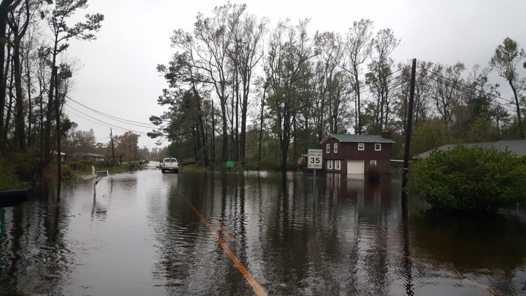
But his neighborhood, built on the site of an old dairy farm, had plenty of full-grown pine trees fall during Florence, along with flooding two to three feet deep on the street as a tidal creek breached its banks and spilled over onto the roadway.
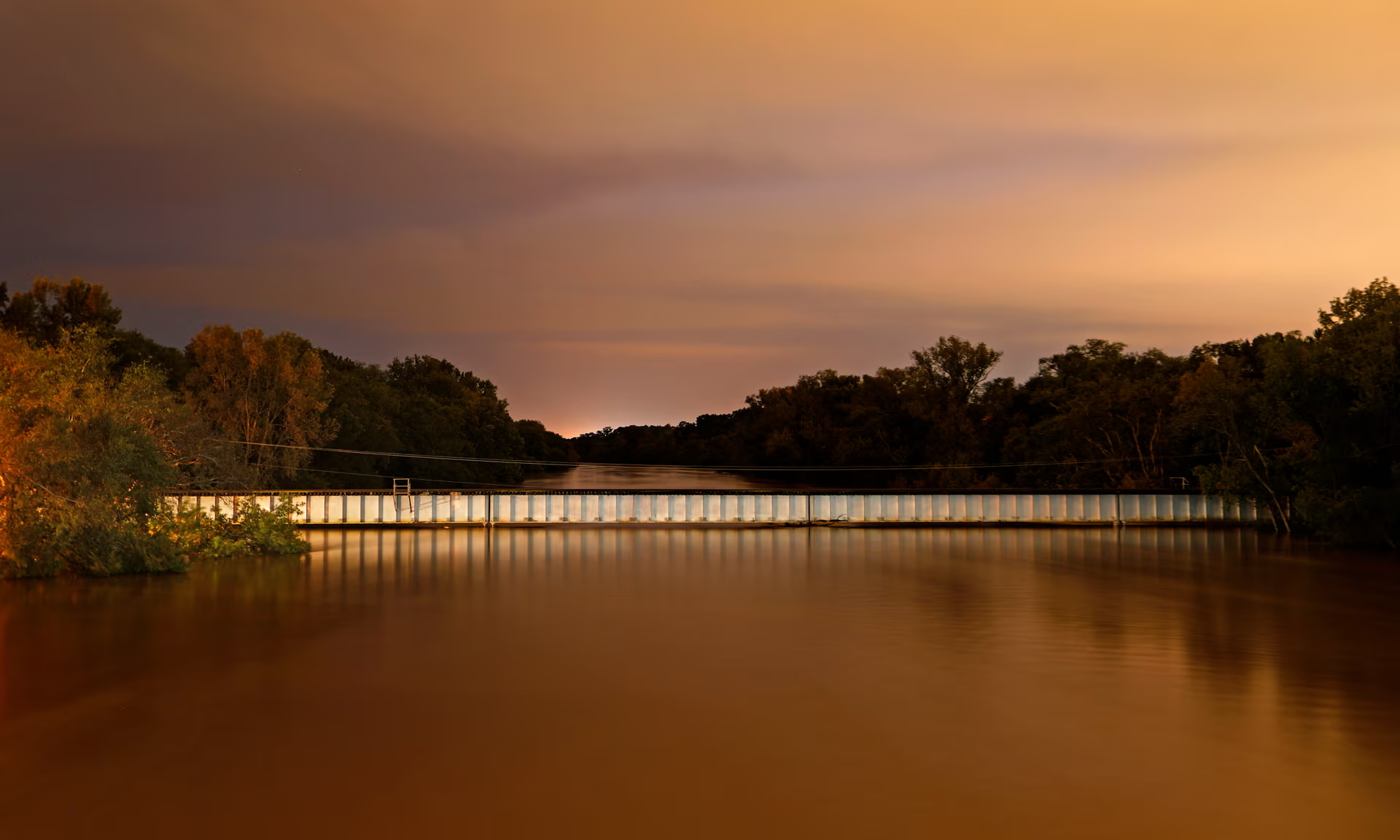
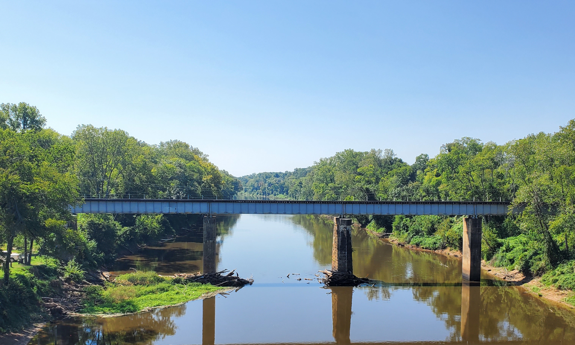
Welch’s Wilmington home is near the end of the line for the Cape Fear River before it empties into the Atlantic. Across its nearly 200-mile length, beginning just north of Greensboro, the river saw persistent flooding as rain-soaked streams and tributaries fed more water into the main branch of the river. That presented ongoing issues long after the rain finally ended on September 17.
“When the sun comes out, there are still forecast challenges,” said Smith. “Some of that gets extended for days or weeks, when the Pee Dee or Cape Fear River is still above flood stage. That impacts recovery, and you’ve got to remind people that the hurricane is gone but the river is still going to rise.”
In the wake of Florence, the National Weather Service continued to provide key decision support services, such as helping emergency managers find bases that wouldn’t flood later, and getting current information on river levels to the Coast Guard so they could assist with rescue efforts.
Pfaff said staff from the Wilmington office were on more than 100 conference calls with state and local officials, and they also set aside time blocks when core partners could call and ask questions.
In that part of the state, the impacts were long-lasting. The Waccamaw River, which runs through eastern Columbus County, was in flood stage for more than a month. And the signs of the human impact were even more apparent.
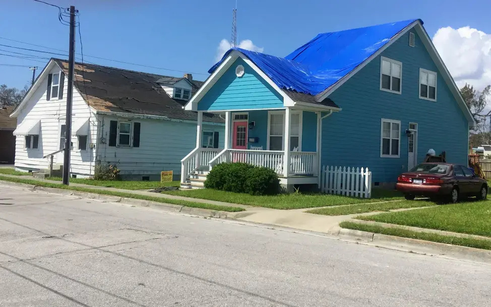
“I remember driving around Wilmington, and it looked like a blue tent city,” said Pfaff. “We talk about flooding from below, but for a lot of the people who lost everything they had, it was because of flooding from above. The water seeps in and gets everywhere.”
Community-Level Changes
An event of Florence’s magnitude was a major learning experience for eastern North Carolina.
In his neighborhood, Welch said he has seen one noticeable change in the five years since Florence.
“A lot of those pines have disappeared since then as people began to realize how vulnerable those trees are during a storm.”
For the National Weather Service, Florence highlighted the need to be involved at the community level. After Matthew, the Raleigh office embedded their warning coordination meteorologist, Nick Petro, with emergency managers in Fayetteville to directly advise them about the local flood risk.
They’re also now providing river forecasts for more locations including the Black River in southern Sampson County, which spilled its banks literally overnight during Florence.
In the past five years, the Wilmington office has begun doing exercises with groups such as Voluntary Organizations Active in Disaster and the New Hanover Disaster Coalition, making sure they can receive weather briefings and short-term forecasts to keep them safe during their own on-the-ground response to hurricanes.
The forecasters all agreed that Florence emphasized how a storm’s winds – it was only a Category 1 at landfall – aren’t always a reliable indicator of its impacts, and can sometimes overshadow the main threat.
“The wind gets so much attention, but the rain is really what gets us,” said Blaes.
Because of the extreme rain amounts it brought, Florence has also given people a new baseline for flooding impacts.
“I was here during Floyd and it had always been the benchmark,” said Pfaff. “Everyone figured if you didn’t flood during Floyd, you’re okay.”
Now, Florence has painted a fresh picture of what flooding can look like – “and acknowledged that 40 inches of rain is possible at this latitude,” he added.
Two storms causing significant freshwater flooding within a two-year period has made forecasters reluctantly experienced with these sorts of events.
“We’re unfortunately somewhat well-practiced in this,” said Blaes. “This is not new, we’ve learned from it, and we’re much more prepared, but every storm is different.”
However, the forecasters who worked through Florence insist that they can never get fully accustomed to some aspects of these storms.
“It’s a lonely experience,” said Bacon. “We were cut off and there was no traffic, no industry – for days, all I heard were helicopters and chainsaws. There was no power for nine days, and you can only live by a candle for so long.”
The statistics associated with Florence – from more than 30 inches of rain to nearly $17 billion in damage – are astounding, but five years later, it’s the impact on people that stands out the most.
And it started with that nerve-wracking lead-up to a storm that it seemed would never end.
- Categories:


