Earlier this month, our office’s Environment and Climate Observing Network, or ECONet, grew to 42 total weather stations with the addition of a monitoring site in Chapel Hill. This was a great example of the necessary steps for putting up a new weather station, so in today’s blog post, let’s take a look at those key components and how the Chapel Hill site ticked each of the boxes.
A Need for Information
In mid-May, the Horace Williams Airport in Chapel Hill was decommissioned. Prior to that in late April, weather observations stopped being taken by the airport’s Automated Surface Observing System, or ASOS, which had been reporting since 1999.
However, just because planes were no longer taking off or landing from the site didn’t mean there wasn’t still a need for weather data.
The Orange Water and Sewer Authority (OWASA) used that information to help with stormwater guidance. The National Weather Service office in Raleigh also told us that there was a great public interest in local observations from the Chapel Hill area.
Many of our ECONet stations were borne out of a similar local need. Several mountain stations are used by the Division of Environmental Quality for monitoring high-elevation winds, which can affect the dispersion of ozone and harmful pollutants.
Twenty ECONet sites across the state are located at Agricultural Research Service stations and field labs, and the weather data from our stations can be directly connected with crop yields, pest management applications, and in-field observations at those facilities.
Education is also a frequent need. We have stations at an elementary school in Buckland, a middle school in New London, a community college in Spindale, and on Bald Head Island at the conservancy, all of which can put local scientific data in the hands of their students.
A Local Partner
NC State and UNC-Chapel Hill may be best known for their athletic rivalries, but this station was an example of a friendly and successful collaboration between the two schools. It helps that our office has strong ties to both universities. Before moving to our current home at NC State, the State Climate Office of North Carolina was originally based at UNC-Chapel Hill from 1976 through 1980 under the leadership of our first state climatologist, Dr. Peter Robinson.
Since then, we’ve maintained relationships with people and groups at UNC, including the Southeast Regional Climate Center (SERCC), with whom we’ve worked since 2007. Because of this partnership, when OWASA was in need of ongoing monitoring information for Chapel Hill, they talked to the SERCC, who connected them with us.
Available Funding
The biggest hurdle toward adding a new weather station often isn’t whether it makes sense, but whether a partner can provide the needed dollars and cents.
To obtain high-quality observations, it is important to start with the proper research-grade instruments. A 10-meter tower and the full suite of roughly a dozen sensors costs around $15,000, with a subsequent annual maintenance cost of approximately $5,000 budgeted per station.
Maintaining an environmental network also takes a lot of work by staff and students. Our data is quality controlled, routine maintenance visits are made at least three times each year, and any identified issues are fixed as soon as possible.
Last year, our uptime — defined as observations being received within one hour of the original observation time — was 97.9%, and 99.5% of data passed our automated and manual quality control routines.
Of course, we know that not everyone has that sort of funding laying around. That makes the partners we do have even more valuable at ensuring an expansive network with consistent, ongoing observations. For our newest station, funding was provided by the Energy Services Department at UNC-Chapel Hill.
A Suitable Station Location
Once funding becomes available, we work with our local partners to choose the best possible station location — ideally, somewhere that’s accessible for us with good wind exposure in all directions and is representative of the local terrain and landscape.
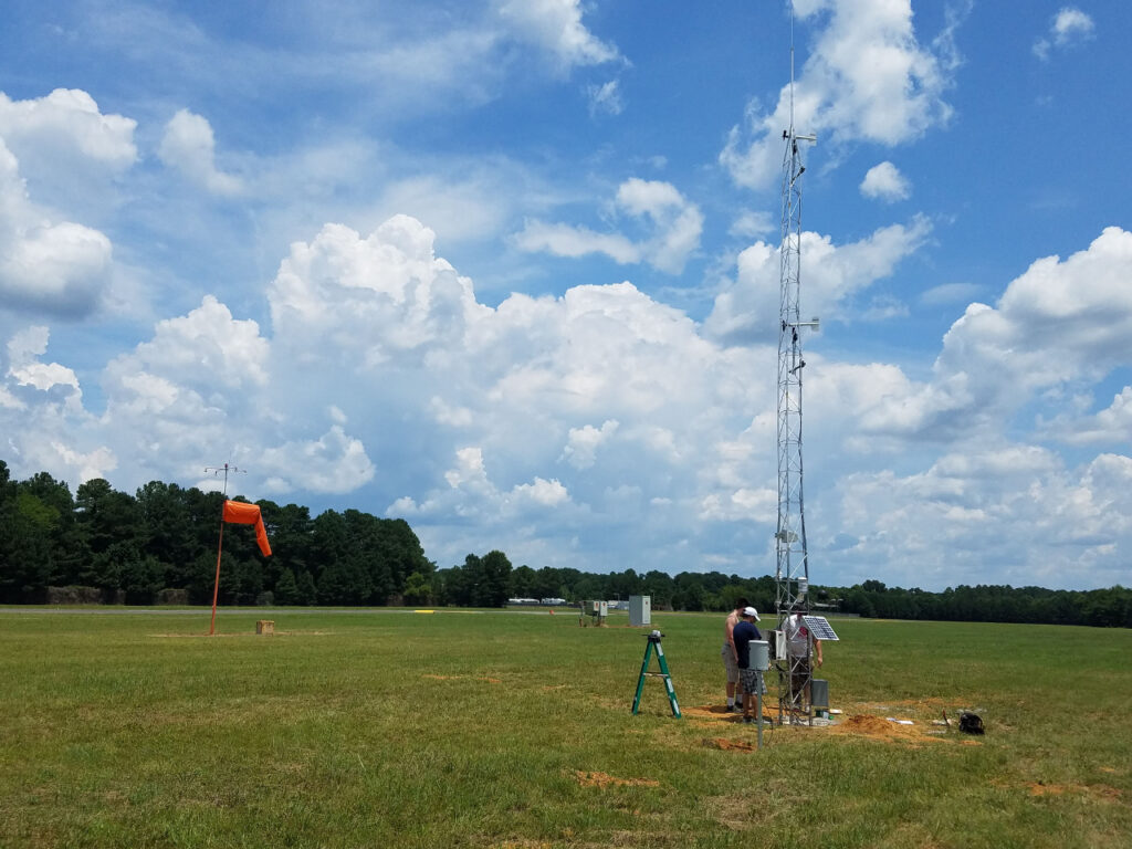
Sometimes, it’s an obvious choice, which was the case for the Chapel Hill station. Since the airport site already had a nearly 20-year historical record, we put our ECONet station about 200 feet from the old ASOS. That location adjacent to the runway was ideal as well, with few nearby obstructions such as trees or buildings.
In other cases, it takes some more searching to find a site that best meets the local partner’s needs, can fit on nearby land, and doesn’t overly compromise our siting requirements to ensure the best data quality. For example, our station at Isothermal Community College took multiple visits at many sites to find a location suitable for everyone involved.
Some Site Preparations
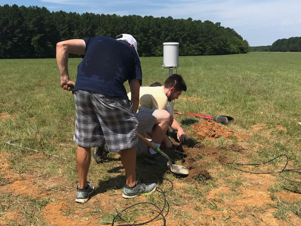
A week or two before we install a new station, we arrive on site to dig a hole 3.5 feet deep and arrange for it to be filled with concrete to anchor the base of the aluminum tower into the ground. At the Chapel Hill site, we secured the base with ropes to make sure it stayed stable and level.
Our station locations sometimes need some TLC before we arrive. Clearing vegetation is the biggest challenge, but as long as the weeds are removed and the vegetation is knocked back, we can install the tower and place the soil sensors in a location that is representative of the entire area.
Some stations require a fence to provide an extra layer of protection from humans and wildlife. However, these fences are usually added after the station is installed so that the tower can be lowered through the gate door opening.
Often, we also need to arrange for a permanent way to get to the station, such as getting keys to any gates that might otherwise restrict access. Many of our mountain stations are behind such gates that close to the public nightly or seasonally.
In Chapel Hill, university facilities staff provided us access to the main entrance leading onto the tarmac at the airport.
A Successful Installation
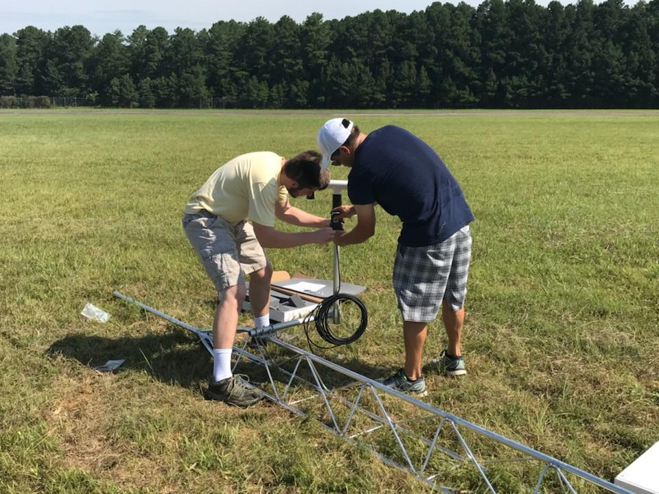
With the prep work out of the way, we can finally install a new station. Depending on the number of people helping, this usually takes 4 to 6 hours. In Chapel Hill, we arrived with a crew of 5 staff and undergrad students around 9 am on July 6 and finished up around 1:30 pm — just before the afternoon’s first showers and storms arrived.
Our first steps were bolting on the remainder of the tower itself, then installing the two propeller anemometers. The World Meteorological Organization’s standard height for wind measurement is at 10 meters, but we also install one at 6 meters to be consistent with the Forest Service’s guidelines for fire weather monitoring.
After raising the tower, lowering it, and raising it again to make sure things were level, we added our near-surface instrumentation. On metal arms extending from the tower at a height of 2 meters, we installed — from left to right in the photo below — a gill shield sensor with air temperature and humidity probes; a pair of pyranometers that measure solar radiation and photosynthetically active radiation; a black globe thermometer; and an all-weather sensor that measures air temperature, humidity, pressure, precipitation (via its impact sensor), and wind speed and direction (via a sonic anemometer).
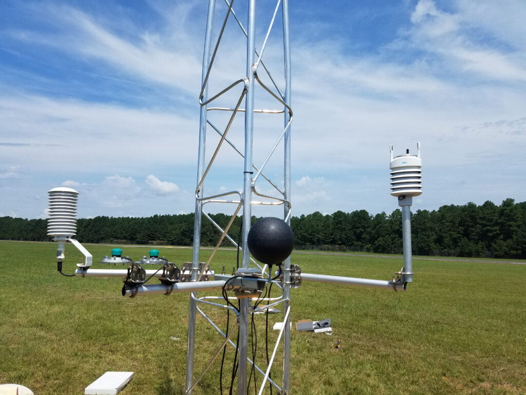
We also installed a rain gauge a few feet away from the station to make sure that water dripping from the tower or other sensors wouldn’t skew the precipitation totals it recorded. Beneath the ground, we buried soil temperature and soil moisture sensors, which further provide a full suite of observations for multiple applications including weather forecasting and monitoring for agriculture, hydrology, and other sectors.
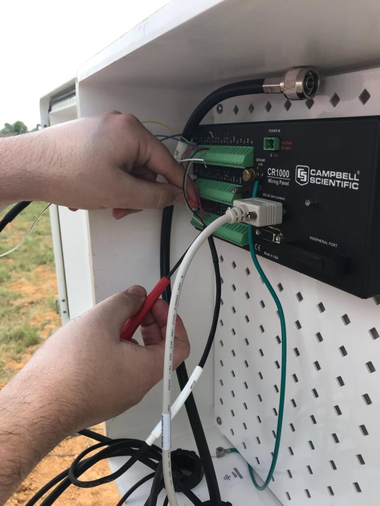
Finally, we wired the sensors into the data logger, installed both a solar panel and a deep-cycle marine battery to supply power, and added a cellular antenna so this station can communicate its observations to our office every five minutes.
While reading all that may sound easy enough, we were doing it in air temperatures of greater than 90°F with a black globe temperature — a proxy for the heat felt in direct sunlight — of 110°F, as measured by the sensors at this site. You as well as our partners can now view this station’s data for yourself in our Weather and Climate Database.
Although we had a hot day for field work, it was an effort worth making to ensure ongoing monitoring for the Chapel Hill area as part of a long-running partnership that made our newest weather station a possibility.