When you hear the term “lake effect snow”, you probably think of the Great Lakes phenomenon that gives cities like Buffalo, NY, several feet of snow each winter. But this morning, thanks to a quirk of our cold weather, lake effect snow is happening right here in North Carolina!
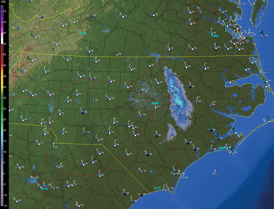
Radar and surface observations from around 9 am showed light snow occurring at Rocky Mount, Wilson, Goldsboro, and Kenansville. This is the result of cold, dense air pushing beneath a layer of relatively warmer, less dense air directly above the lake surface, which forces that warm air to rise. As it rises and cools, clouds and precipitation form.
This is a common occurrence over the Great Lakes but is quite rare for North Carolina since our lakes are much smaller and our air is not usually cold enough compared to the lakes’ temperature to produce this effect.
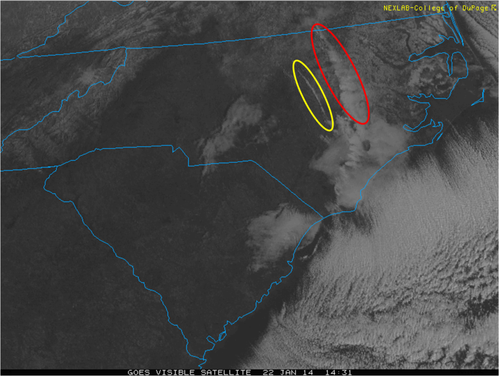
The satellite image above shows a band of clouds originating from Kerr Lake (within the red circle) and streaming southeastward into the Coastal Plain. A second, smaller stream of clouds can be seen originating from Falls Lake (within the yellow circle).
This morning’s lake effect snow was heavy enough to reduce visibilities at the Rocky Mount-Wilson Airport to just 1 mile. It should also add a bit more snow to the inch or two they received last night when a low pressure system developed over the state and moved offshore, which ushered in cold air and a few hours of snow for the northern Piedmont and Coastal Plain. The remaining snow on the ground in the northeastern part of the state is also visible in the satellite image above.