Dryness Creeps Back in During September
Monthly statistics for September 2013:
Statewide Average Precipitation: 3.00 inches (36th driest since 1895)
Statewide Average Temperature: 69.1 degrees (42nd coolest since 1895)
* Values generated from preliminary numbers
Cool Temperatures Continue
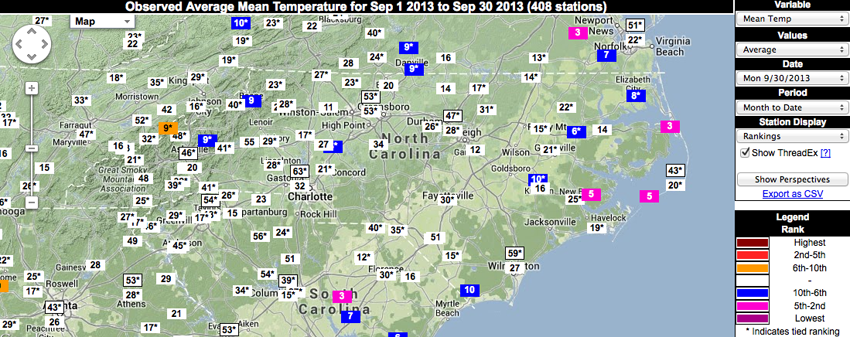
Much like the summer months, September was marked with temperatures on the cooler side of normal — 0.3°F cooler statewide, to be more precise. While most individual locations across the state weren’t significantly colder than normal, a few stations did rank September 2013 mean temperatures in the top 10 coldest on record for the month, namely: Elizabeth City, 8th coldest in the station’s 51-year history; Williamston, tied for 6th coldest in it’s 58-year history; and Salisbury, tied for 8th coldest in the station’s 118-year record.
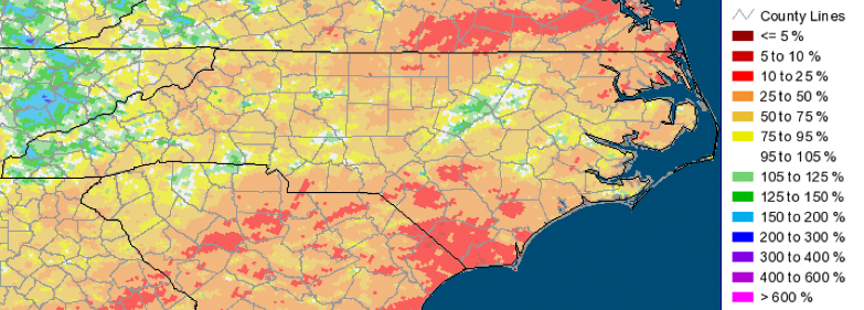
Mostly Dry, with a Few Exceptions
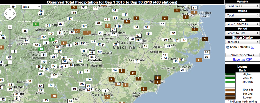
September 2013 brought some relief from the rain for many parts of the state, although a few select locations saw a substantial amount of precipitation. Some stations ranked last month in the top 10 driest Septembers on record. In addition to having a cool month, Elizabeth City ranked September 2013 as it’s 4th driest. Whiteville and Lumberton ranked last month as the 5th driest September in each station’s respective historical record. And perhaps most notably, Wilmington experienced the 2nd driest September on record in the station’s 80-year history. Going against the grain was a station in Oconaluftee in western NC, which recorded it’s 10th wettest September.
Relatively Calm, Comparatively Speaking
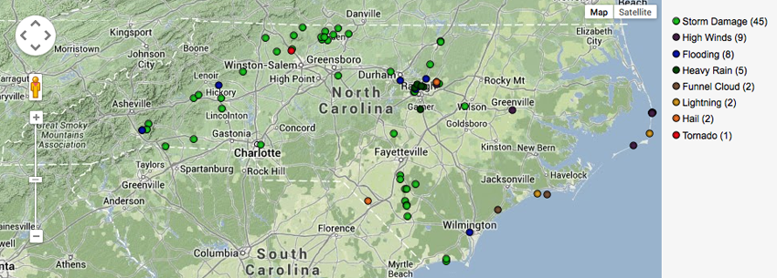
Far fewer storm reports were issued last month, especially when compared to the very active summer months — particularly June and July. However, September wasn’t completely devoid of the more severe aspects of weather. Several reports of damage (downed power lines and trees) and flooding resulted from storms that moved through NC during the latter half of Labor Day weekend. Storms observed on the 21st brought additional damage to parts of the state, as well as a confirmed EF-1 tornado near the Stokes/Forsyth County line that damaged a home and destroyed a barn.
Impacts to Agriculture and Water Resources
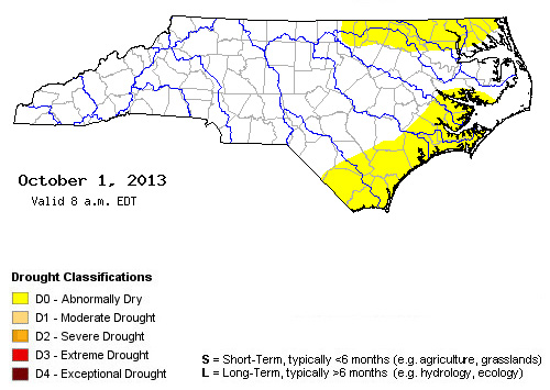
Overall, drier conditions were welcomed last month for many in the agricultural community, as farmers were given more time in the fields for harvesting. Monthly average streamflow conditions hovered around normal in September across most of the state, with some mountainous areas observing above normal flows, and areas in the eastern part of the state seeing below normal conditions. Drought indicator wells showed normal to above-normal groundwater levels for most of the state, with exceptions in the east indicating drier conditions. After a summer of no drought for North Carolina, the lack of precipitation last month — in particular along the southeastern coast and northeast along the NC/VA border — ultimately resulted in an “Abnormally Dry” drought classification (D0) for those areas. However, rainfall over the past few days may very well negate this recent classification.
- Categories:


