This is the second part of our weeklong blog post series Century Since the Storm.
One of the greatest meteorological advances since 1913 is our improved ability to track and forecast hurricanes. These days, it is quite literally down to a science: Geostationary satellites observe systems from their birth as tropical thunderstorm clusters, reconnaissance aircraft fly into the storms to collect data, and computer models predict the storm tracks several days in advance, often accurate within a hundred miles.
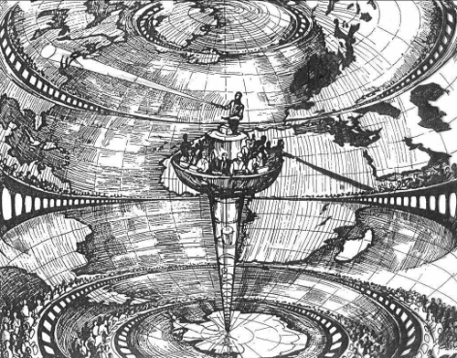
But none of this technology existed in 1913. Orbiting satellites and Hurricane Hunter aircraft were a long way off — man’s first powered flight was achieved just ten years earlier, along the North Carolina coast in Kitty Hawk. And scientists at the time had a very different vision for a computer model: Early forecaster Lewis Fry Richardson imagined a huge factory where 64,000 mathematicians would each calculate the weather for a small part of the world, collectively creating a forecast.

Leading up to the 1913 hurricane’s landfall at Cape Lookout, forecasters had little information to go off of, and provided very little lead time ahead of the event. In the September 1913 issue of the Monthly Weather Review — a journal still published today — meteorologist H. C. Frankenfield notes that early hints about the presence of a storm were scarce:
On August 29 there was a slight pressure fall over the Windward Islands to the southeastward and the fall probably drifted normally to the northwestward without attaining true cyclonic development until assisted by the heat and moisture of the Gulf Stream during the night of August 31-September 1.
Additional scant reports, via radiogram messages from ships, indicated that the storm was only a few hundred miles off the coast of North Carolina. On September 2, when the barometric pressure at Cape Hatteras began to fall and the winds and rain began along the Outer Banks, storm warnings were issued along the coast.
In 1913, the National Weather Service and National Hurricane Center did not yet exist, so their forerunner, the U.S. Weather Bureau, was responsible for issuing forecasts and warnings. The Hatteras Weather Bureau Station was used to receiving important information: The previous year, the station received a distress call from the Titanic. So as the storm neared the coast, the station’s observers were ready to collect and disseminate observations as they came in from both the land and sea.
In the video below, National Park Service ranger Lamar Tate discusses the history of the Hatteras Weather Bureau Station and the role of the U.S. Weather Bureau as a pioneer of weather information and forecasting.