This week marks the halfway point for summer, and the first series of days in quite a while that have “typical” summer weather in North Carolina. How does the cool, wet start to summer compare with other years?
Here are some statistics since June 1:
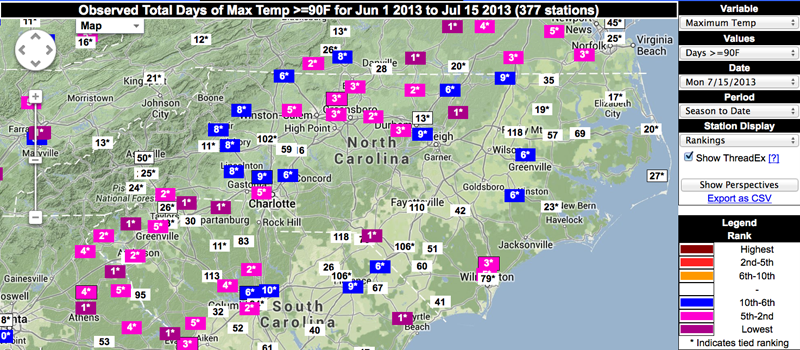
- Temperatures greater than 90°F: For most locations in NC, 2013 has the fewest number days to this point with maximum temperatures that reached or exceeded 90°F in more than 30 years.
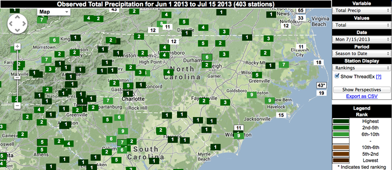
- Total Rainfall: For most reporting stations in NC, the total amount of precipitation ranks as the top 5 wettest start to summer on record. As mentioned in the recent climate summary post, the statewide average for June 2013 ranked as the second wettest since 1895.
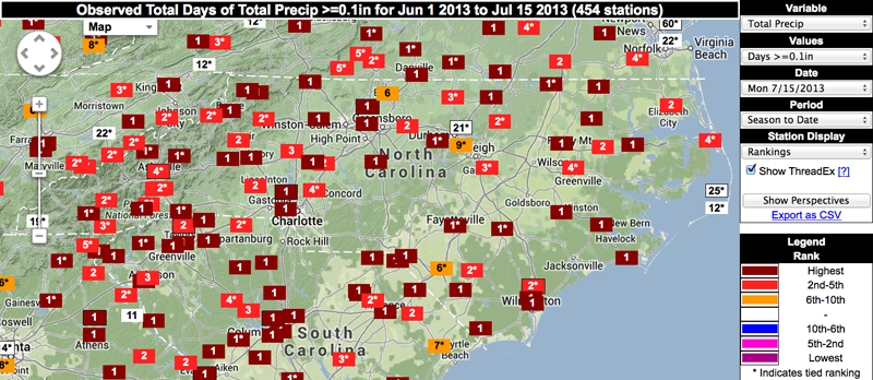
- Days with Rain: Most stations also report more days with measurable rain since June 1 than any other year of record.
So its not just your imagination: summer 2013 has truly been unusual, at least so far.
Interestingly, if you were to only look at average daily temperatures, 2013 summer isn’t much different than 2012. But the differences in daily high and low temperatures is huge! In 2012, we had dry conditions with very warm daytime high temperatures and cool overnight lows. In 2013 we have the opposite – very warm overnight lows and cool daytime highs. If you average the highs and lows for each year and compare average daily temperature, the numbers suggest similarity between two summers that are actually very different.