Organic Soil Moisture Monitoring
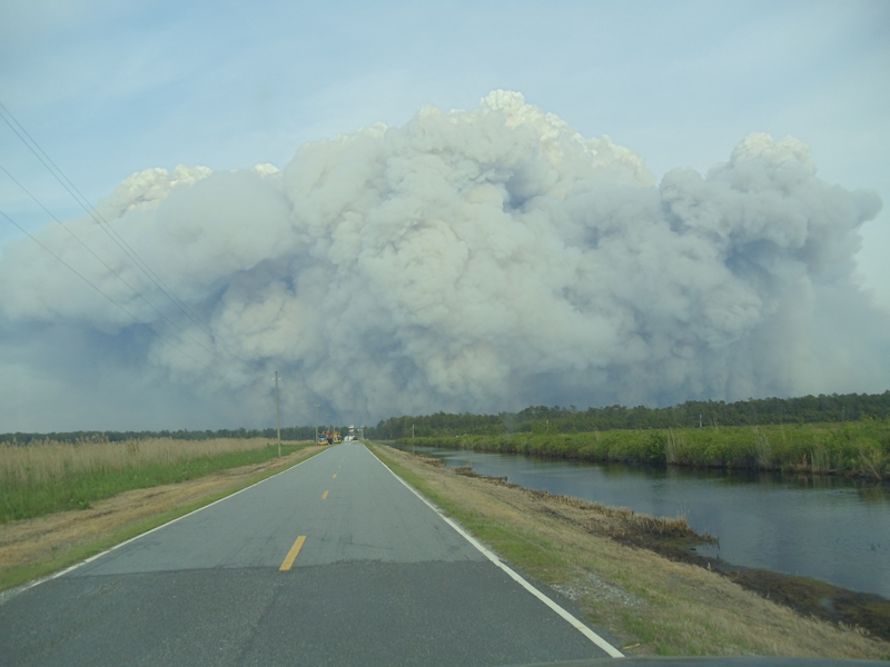
Historically, North Carolina’s largest wildfires have occurred not on treacherous mountain slopes or in dense Piedmont pine plantations, but in remote coastal peatlands. Parts of eastern North Carolina are unique for their soils rich in organic matter, which creates many monitoring and management challenges, especially surrounding fire danger.
While these peat soils tend to resist moistening, their location in low-lying swamp-like environments means they’re typically submerged year-round. However, during drought events, the water table drops and these soils dry out, which creates a tinderbox due to their readily burning organic composition.
Wildfires that start in organic soils can burn for weeks or months at a time, often beneath the surface as the soils can reach more than 10 feet in depth. These fires tend to produce abundant smoke, which when spread by the wind can dangerously reduce air quality across population centers in and outside of the state. This stubborn nature means that containment strategies are often limited to dousing the soils with water and waiting for them to burn or smolder out, usually after consuming several feet of soil.
To help answer some of the ongoing questions about fire and smoke in organic soils, the SCO has engaged in research to advance the science of monitoring organic soil moisture.
In 2015, an analysis at the SCO supported by the NIDIS Coastal Carolinas DEWS program largely confirmed previous knowledge: that organic soil moisture is not well-correlated with traditional fire danger or drought indices. This study used a soil humidity dataset from three sites in eastern North Carolina. However, due to gaps in the data and uncertainties about the sensor being used, we decided to undertake our own monitoring effort, supported by our statewide and regional partners.
Beginning in spring 2018, we deployed four organic soil moisture monitoring stations. The Nature Conservancy and the US Fish and Wildlife Service supported two stations on the Pocosin Lakes Wildlife Refuge. They are using these stations’ data in their own project examining differences between managed and unmanaged blocks of the refuge, which can vary in water table height especially during dry periods.
The Carolinas Integrated Sciences and Assessments supported the installation of two additional stations: one at the Dismal Swamp State Park in the northern Coastal Plain, and another at the Green Swamp Preserve in the southern Coastal Plain. We worked with local partners at the NC Parks Service and The Nature Conservancy to determine the most suitable locations for these stations and provide data access through the Fire Weather Intelligence Portal.
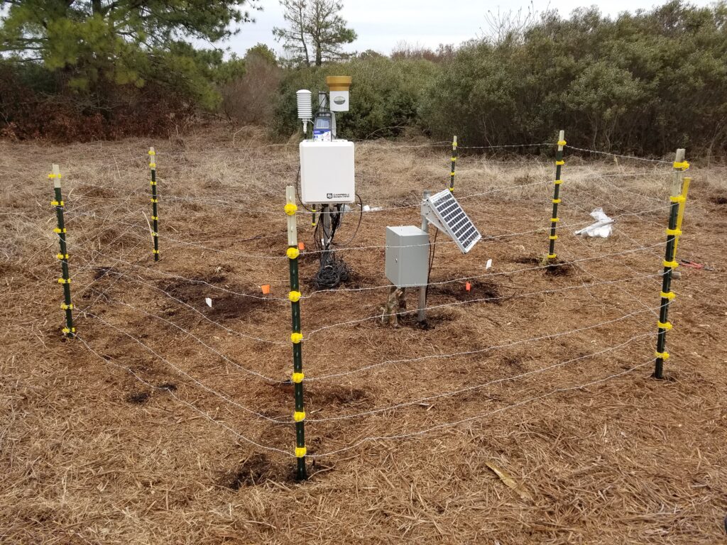
All four stations use a robust and redundant set of research-grade soil moisture instrumentation, arranged in three columns with sensors at depths of 5 cm, 10 cm, 20 cm, 50 cm, and 100 cm. Data is measured every 15 minutes and reported back to our office hourly via cellular modem.
Monitoring is ongoing at these sites, and later this year, we expect to begin an analysis of the data collected so far. Building on our findings from the 2015 study, we plan to look for any environmental indicators or proxies for organic soil fire or smoldering risk, expanding our candidates to include remotely sensed datasets such as the satellite-derived SMAP product. We will also look for trends in the multi-level soil moisture data during dry periods, and attempt to create a set of guidelines or rules-of-thumb that land managers can consult to check for increased fire or smoldering risk.
Using our station design as a template, NC Forest Service plans to deploy up to two additional organic soil moisture monitoring stations. While on-site instrumentation like this is not practical at every at-risk organic site in eastern North Carolina, the data from these sites will serve as the critical ground truth behind ground fire risk.