From Snow Cones to Snow Showers: April 1983’s Snow and Freeze

Thirty-three years ago this week amid a warm spring in 1983, an April shower brought a record-setting springtime snow, followed by several days of sub-freezing temperatures that wrecked havoc on the summertime fruit crop.
Not unlike our recent winter, the winter of 1982-83 featured a strong El Nino event in the Pacific that brought wet weather across the state. However, snow events in January and February were minor outside of the Mountains.
Conditions became more active by March thanks to a dynamic polar jet stream. When the jet stream weakened and cold air filtered in, the state received two springtime snow events, including one on March 24 that brought up to a foot of snow in Tarboro.
But that wasn’t the only wintry event in the spring. By mid-April, the polar jet stream again weakened and the North Atlantic Oscillation, which describes its strength and position, became negative. That again opened the door for cold air and wintry weather. According to historical weather records, a freak spring snowstorm moved across the state on April 18, 1983 producing record snowfalls for that late in the year.
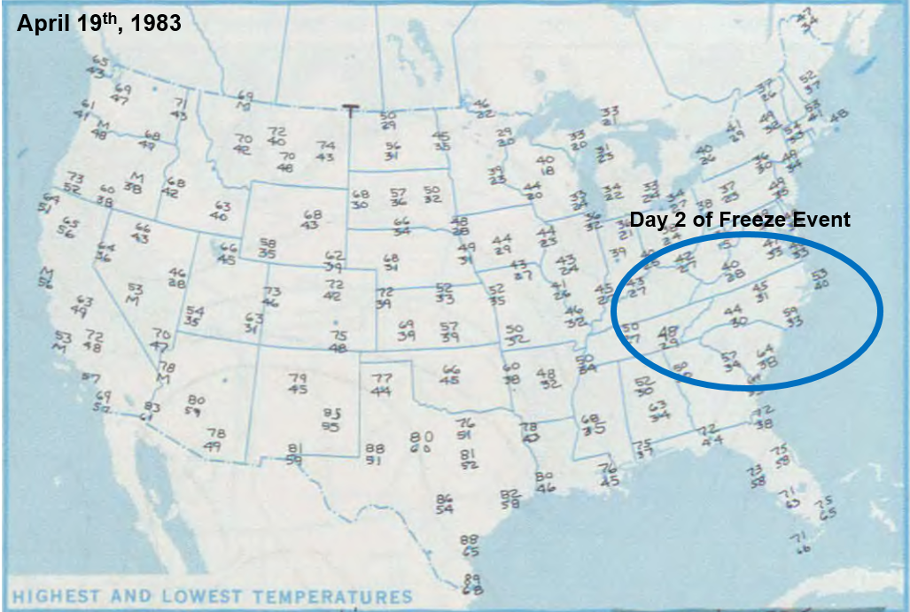
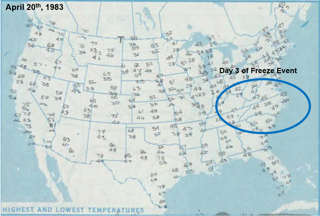
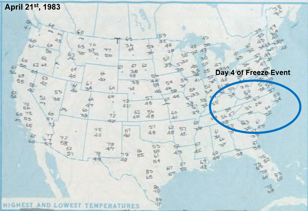
The cold spell that followed the snow was much more damaging, as countless record low temperatures were recorded across the state. Many stations recorded five consecutive nights of sub-freezing temperatures, which devastated many of the state’s agricultural commodities.
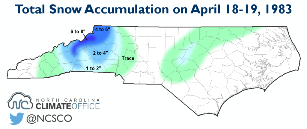
Snow Day: April 18, 1983
Less than a week before the snowstorm, North Carolina was enjoying seasonal spring temperatures in the upper 60s and low 70s. During those blissful spring days, a storm was building across the central United States, setting the stage for a round of wintry weather halfway through the spring.
As the low pressure system moved through North Carolina, it brought precipitation beginning as rain around 6 am in Asheville and by noon in Raleigh. As rain fell through the dry atmosphere, evaporative cooling took effect. Eventually, the rain transitioned to a rain/snow mix, and finally to all snow.
While warm ground temperatures largely kept the snow from sticking, a dusting to a few inches accumulated in some spots. Snow totals ranged from 7 inches in some mountain locations to 2 inches in parts of the Piedmont.
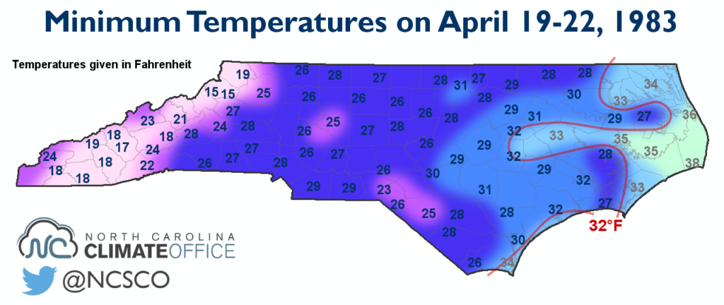
Flash Frozen
After the low pressure system passed through, a cold and stable air mass moved in, and with a blocking high to our north, it was here to stay for four straight days.
Throughout this period, nighttime temperatures dipped below the freezing mark across the state. In the Mountains, temperatures hit the upper teens, including a low of 17°F in Boone. Even along the coast, Wilmington’s low temperatures reached at or below the freezing mark on two straight nights.
Eventually, the cold air moved out and within another week, temperatures returned to the 70s once more. However, the stretch of freezing temperatures could not have happened at a worse time for North Carolina growers.
Impacts and Records
Mid-April is the typical start of the growing season since we almost always see our final spring freeze before then. However, freezing temperatures during this time can have a significant effect on crops.
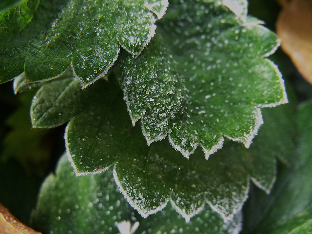
According to the storm report from NOAA, the peach crop was hit the hardest. Between 80 and 90% of the crop destroyed, amounting to $10 million — almost $24 million in today’s currency — in damage. Apples, strawberries, blueberries, and other crops suffered lesser yet still substantial damage.
The 5 inches of snow at Boone and 1.8 inches at the Raleigh-Durham Airport were both record amounts for so late in the year. While Boone has seen snow later in the spring, including 2 inches in May 1989, the April 18, 1983, snow is the latest on record in Raleigh.
From the snow events in March and April to the damaging and prolonged late-season freeze, the winter of 1983 seemingly didn’t want to end in North Carolina, and its longevity and extremity carried a hefty price tag for the state’s agriculture industry.
- Categories:


