New high-resolution guidance for a number of key fire and smoke parameters is now available across the Southeast region in the Fire Weather Intelligence Portal.
These grids are based on the National Weather Service’s National Blend of Models, which combines several atmospheric forecast models into a single skillful product. Data is available at a spatial resolution of 2.5 km (1.6 miles), and forecasts are available at hourly or three-hourly intervals up to five days out.
The raw NBM forecasts include Mixing Height and Transport Wind Speed, or the average wind between the surface and the mixing height above a given point. Using these and other forecasted parameters, we are now calculating Burning Category (using state-specific breakpoints, where available), Pasquill-Turner Stability Class, Atmospheric Dispersion Index, and the Low Visibility Occurrence Risk Index (LVORI).
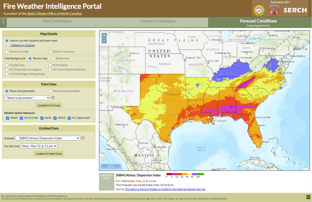
More information about these parameters and the NBM product is available in our Forecast Products user guide section.
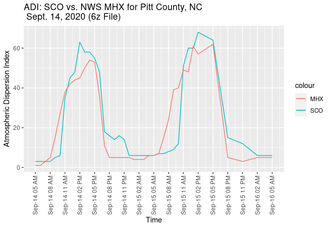
This development work at the State Climate Office of North Carolina was led by Darrian Bertrand, now with the Oklahoma-based SCIPP group. Her efforts also included a case study comparing the NBM-based grids with forecast grids from National Weather Service offices covering North Carolina for a two-day prescribed burning window on September 14-15, 2020, at eight locations across the state.
This showed closely matched forecasts, aside from some small differences in the timing of ADI (below) and LVORI increases in the morning, decreases in the evening, and the magnitude of the mid-day maxima. The NBM-based forecasts reached slightly higher afternoon ADI values than the NWS fire grids, at least over this analysis period. Stability class values were generally within one category and often identical between the two forecasts products.
The addition of the NBM-based fire grids represents the latest step in expanding the Portal to inform prescribed burning and condition monitoring across the Southeast region.