During hurricane season, tropical systems generally move westward across the Atlantic Basin towards North America. Some systems may form into hurricanes staying over open waters during their lifespan, while a few may make landfall, even in North Carolina. This leads to an interesting climatological question: Do hurricanes making landfall in North Carolina share a common trajectory?
Background on Hebert Boxes
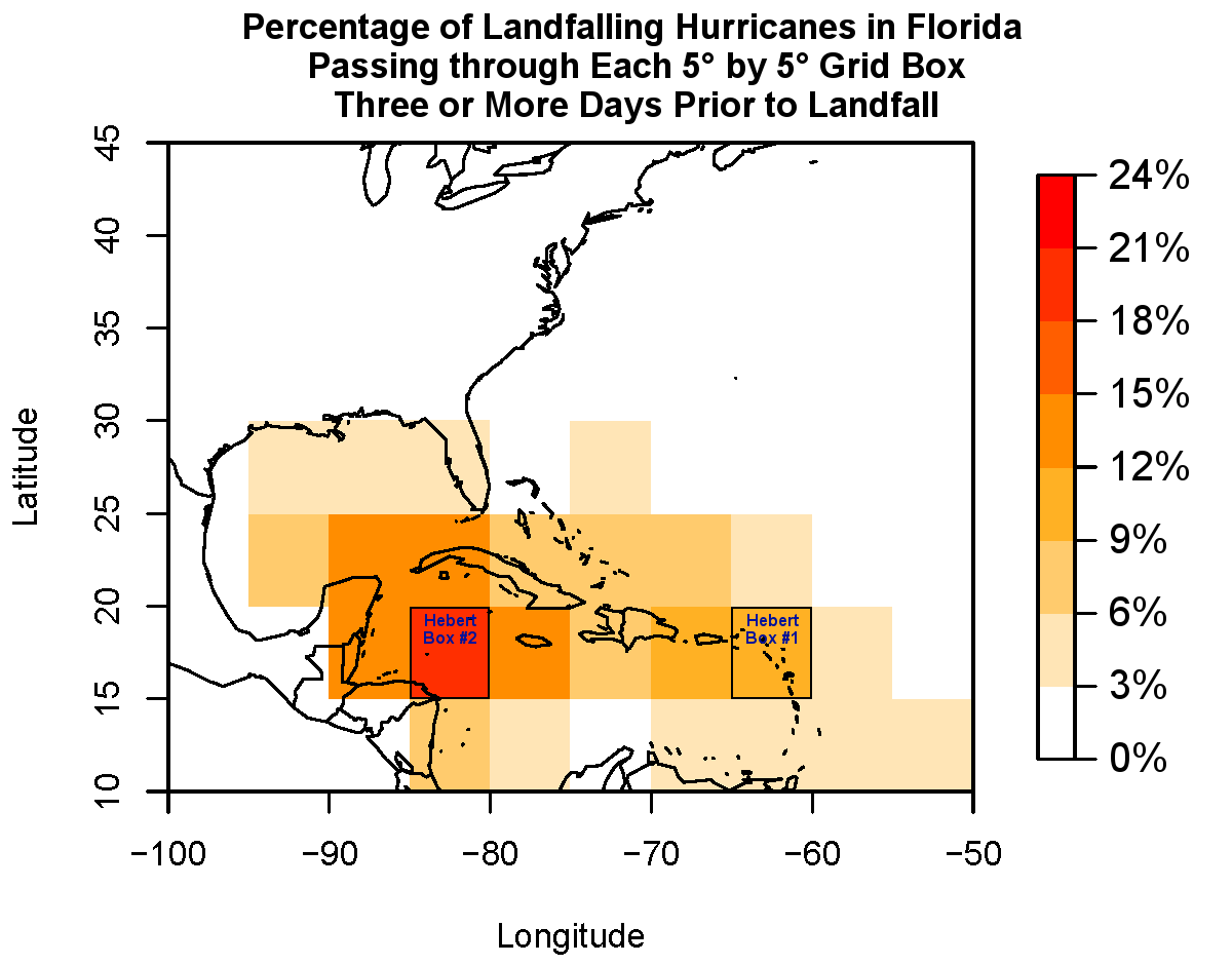
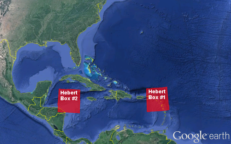
A similar idea was examined in the late 1970s by former National Weather Service and National Hurricane Center forecaster Paul Hebert. He noticed that many of the major hurricanes striking Florida tended to pass through one of two small regions (now called Hebert boxes) in the Caribbean Sea, shown on the right.
Hebert boxes did not include every storm that hit Florida, nor did every storm passing through a Hebert box eventually hit Florida. But Hebert saw them as a good indicator of potential landfalls in the Sunshine State. Our own analysis shows that among all hurricanes that eventually hit Florida, about one third of them passed through either of the Hebert boxes. The westerly box and those around it have the highest percentage, capturing storms moving up from the south.
Defining Boxes for North Carolina
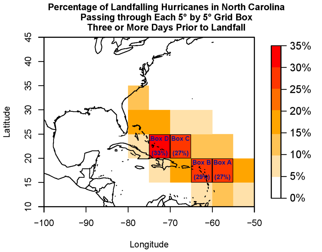
Can the Hebert box concept be applied to North Carolina? We were curious to see where North Carolina’s landfalling hurricanes have historically tracked, so we did our own analysis. First, we found the 45 storms that made direct landfall as hurricanes in North Carolina since records began in 1851. Second, we determined which 5° latitude-by-5° longitude grid boxes these storms passed through three or more days prior to making landfall.
The results show four boxes through which at least 25% of North Carolina’s landfalling hurricanes have traveled. Boxes “A” and “B” include the first Hebert box for Florida, indicating that many of NC’s landfalling storms begin on a similar trajectory to those striking Florida. North Carolina’s landfalling storms then tend to turn northwestward into boxes “C” or “D”, located north of Puerto Rico and Hispaniola and from the Bahamas east.
NC’s Storm Tracks
Altogether, 31% of North Carolina’s landfalling hurricanes have passed through boxes “A” or “B”, and 36% have passed through boxes “C” or “D”. That means those two boxes capture a slightly higher percentage of North Carolina’s landfalling hurricanes than the two Hebert boxes do for Florida.
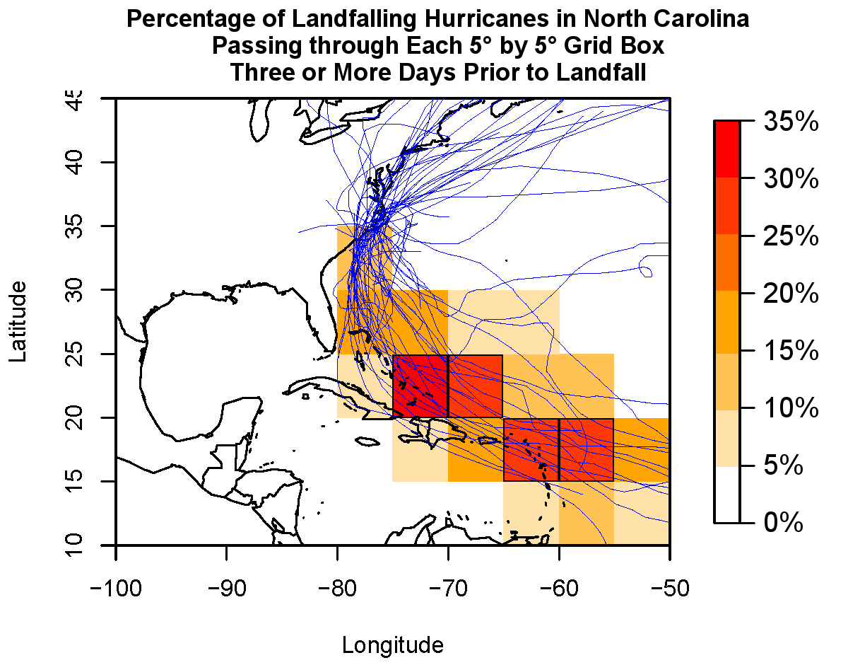
When all of North Carolina’s landfalling storm tracks are overlaid on these boxes, you can see their typical trajectories. Storms passing through or developing in boxes “A” or “B” generally begin as African easterly waves — tropical disturbances that move off the African coast and cross the Atlantic. The position and strength of the large-scale Bermuda high pressure system often dictates the tracks of these storms:
A Northerly/”Box C” Track
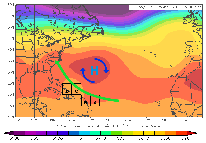
Notable Examples: Bonnie (1998), Ione (1955), Connie (1955)
A Southerly/”Box D” Track
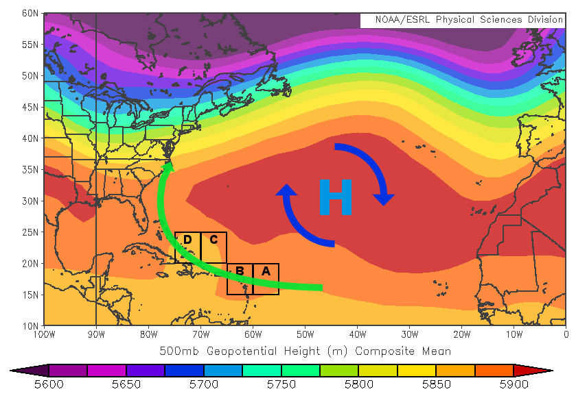
Notable Examples: Irene (2011), Floyd (1999), Bertha (1996)
Applications for North Carolina
Are these results useful? As predictors of landfalls, they may not be as useful as the Hebert boxes were when they were developed in the 1970s. That’s because forecasts models have improved substantially in that time. The National Hurricane Center’s average forecast track error three days ahead of time was more than 400 miles in 1980, but it’s just 132 miles now. That means we can often tell whether a storm might hit North Carolina before it ever passes through boxes “C” or “D”.
From a climatological standpoint, though, these boxes are a simple way to describe the common trajectories of many of North Carolina’s landfalling hurricanes, which makes it an interesting analysis nonetheless.