A Warmer, Wetter Start to Winter in December
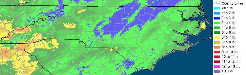
December brought welcome precipitation and relatively warm temperatures to North Carolina. Let’s review precipitation patterns first.
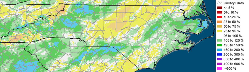
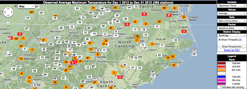
Western and eastern parts of the state did quite well. Two major rain events (and a couple of smaller events) brought substantial amounts to the mountains and the coastal plain. However, much of central NC missed out on the heaviest rain, and still had slightly below-normal amounts for the month. Statewide average precipitation for December 2012 ranked as the 42nd wettest since 1895 (wettest December was in 2009; driest was in 1965). The rainfall was welcome everywhere, and brought drought relief across the state, especially to fields and surface reservoirs. More on that later – next let’s review the temperatures across the state. Below are the temperature rankings from the NOAA SE Regional Climate Center.
Most of the stations reporting for this period showed maximum temperatures ranking in the top 20 warmest, and several sites reported average maximum temperatures that ranked in the top 10 warmest on record.
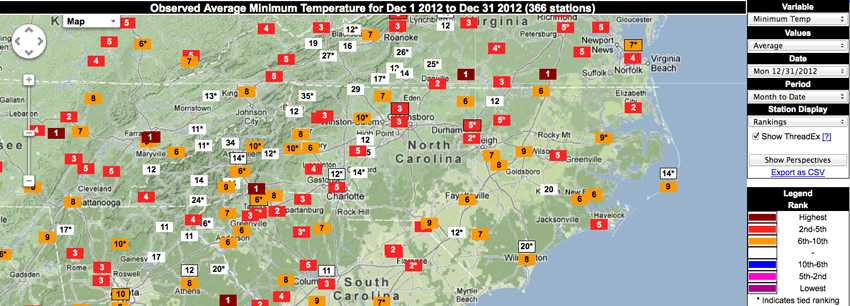
Minimum temperature rankings were even more interesting, as overnight lows didn’t get very cold in December. Most of the state had minimum temperatures rank in the top 10 warmest, with many reporting one of the 5 warmest Decembers on record. Overall, this ranks temperatures for December 2012 as the 8th warmest December since 1895. The hottest December was in 1956, while the coldest was observed in 1917.
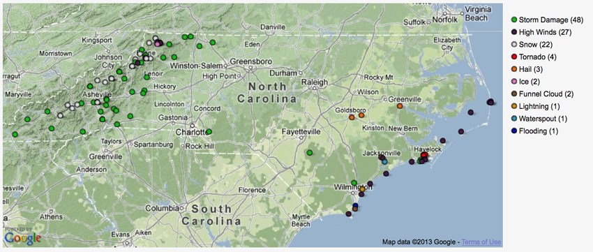
With more storms, we also had more severe weather and storm damage in December. The Local Storm Reports summary below provides reports for the month. I’ll comment on 2 extreme events.
First, the weekend before Christmas brought intense wind flow from the northwest with snow and damaging winds to western NC. Sustained winds at Grandfather Mountain peaked above 80mph, and gusts were reported above 120mph.
Second, a tornado was confirmed near Morehead City from a storm system that moved through on December 26th. This storm also produced numerous reports of wind damage to coastal communities. The NWS office in Newport has a nice event summary for this storm.
Impacts to Water Resources
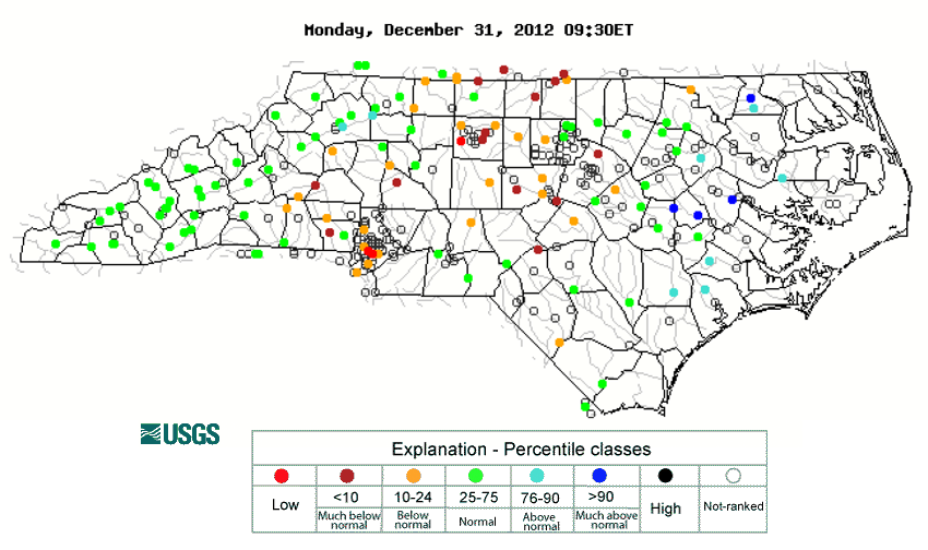
By the end of December, most surface reservoirs had shown substantial drought recovery, even in central NC where rainfall totals were lower. During this time of the year, soils saturate more quickly and most of what falls from the sky goes into recharge for our surface reservoirs and (more slowly) our groundwater storage. While not every lake is full, reservoir managers are much less concerned than they were in early December.
Impacts to Agriculture
During the cool season, it doesn’t take much precipitation to ensure adequate moisture for the few crops in the ground. Rain in December was generally adequate, and there aren’t any concerns right now due to short-term dryness.
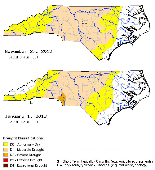
US Drought Monitor
All this would suggest a big improvement in the US Drought Monitor depiction, right? There were some improvements across the month, but there is one primary drought indicator that is still showing signs of drought – streams. Big storms rush lots of water into streams for a few days and can quickly fill up reservoirs, but without adequate recharge over several months to our groundwater, streams quickly dip back down into drought stages.
This is the situation we observed after each of the big events in December. Streams spiked for a few days, reservoirs recovered, but then streams drop back down. By the end of December, many streams were low and back into drought levels. A few heavy rainfall events aren’t as useful for groundwater recharge as many smaller, more frequent storms.
- Categories:


